Area Overview for SY7 8NN
Photos of SY7 8NN
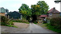
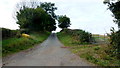
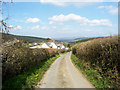
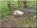
8 photos from this area
Area Information
Key information about the SY7 8NN including its size, population, and administrative classification.
- Area Type
- Postcode
- Area Size
- 19.8 hectares
- Population
- 2199
- Population Density
- 12 people/km²
House Prices in SY7 8NN
4
Properties
£320,000
Average Sold Price
£140,000
Lowest Price
£500,000
Highest Price
Showing 4 properties
| Address | Type | Beds | Baths | Last Sale Price | Last Sale Date | |
|---|---|---|---|---|---|---|
| Burlow Cottage, Birches Mill Llanhedrick To Far End Junction Llysty, Argoed, Clun, SY7 8NN | house | - | - | £140,000 | Jul 2022 | |
| Stepaside, Bryn Junction To A 488 Junction Tadpole Bank, Bryn, SY7 8NN | house | - | - | £500,000 | Jul 2008 | |
| Burlow Farm, Birches Mill Llanhedrick To Far End Junction Llysty, Argoed, Clun, SY7 8NN | house | - | - | - | - | |
| Agricultural Buildings North West Of Colstey Farm, A 488 From Castle Street End To Start Of Colstey Bank, Clun, SY7 8NN | Farm | - | - | - | - |
Energy Efficiency in SY7 8NN
Amenities
Schools
| Rank | School | Type | Entry gender | Ages |
|---|
Explore more schools in this area
Go to Schools tabDemographics
Household Size
Two person
most common
Accommodation Type
Houses
most common
Tenure
80
majority
Ethnic Group
White
most common
Religion
N/A
most common
Household Composition
N/A
most common
Age
47
median
Adults (30-64 years)
most common
Household Deprivation
N/A
with no deprivation
NS-SEC
35
in Lower managerial occupations
Explore more demographic insights in this area
Go to Demographics tabPlanning
Planning Constraints
- Flood RiskPremium
- Ramsar Wetland SitesPremium
- Area of Outstanding Natural BeautyPremium
- Protected Nature ReservePremium
- Protected WoodlandPremium