Area Overview for SY6 6HF
Photos of SY6 6HF
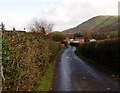
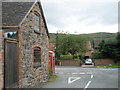

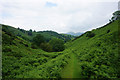
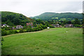
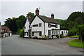
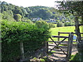
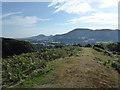
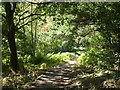
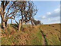
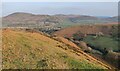
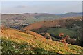
68 photos from this area
Area Information
Key information about the SY6 6HF including its size, population, and administrative classification.
- Area Type
- Postcode
- Area Size
- 1.8 hectares
- Population
- 2343
- Population Density
- 206 people/km²
House Prices in SY6 6HF
7
Properties
£365,600
Average Sold Price
£250,000
Lowest Price
£508,000
Highest Price
Showing 7 properties
| Address | Type | Beds | Baths | Last Sale Price | Last Sale Date | |
|---|---|---|---|---|---|---|
| Wychwood, Shrewsbury Road, All Stretton, SY6 6HF | Bungalow | 3 | - | £508,000 | Jul 2025 | |
| Roseleigh, Farm Lane, All Stretton, SY6 6HF | house | - | - | £390,000 | Aug 2015 | |
| Sunnybrook, Batch Valley, All Stretton, SY6 6HF | house | - | - | £370,000 | Aug 2012 | |
| Gaerstones, Shrewsbury Road, All Stretton, SY6 6HF | Detached | - | - | £310,000 | Aug 2007 | |
| Lavernock Park, Shrewsbury Road, All Stretton, SY6 6HF | house | - | - | £250,000 | Aug 1998 | |
| Mynd Lodge, Shrewsbury Road, All Stretton, SY6 6HF | house | - | - | - | - | |
| Essex Lodge, Shrewsbury Road, All Stretton, SY6 6HF | Detached | - | - | - | - |
Energy Efficiency in SY6 6HF
Amenities
Schools
| Rank | School | Type | Entry gender | Ages |
|---|
Explore more schools in this area
Go to Schools tabDemographics
Household Size
Two person
most common
Accommodation Type
Houses
most common
Tenure
77
majority
Ethnic Group
White
most common
Religion
N/A
most common
Household Composition
N/A
most common
Age
47
median
Elderly (65+ years)
most common
Household Deprivation
N/A
with no deprivation
NS-SEC
45
in Lower managerial occupations
Explore more demographic insights in this area
Go to Demographics tabPlanning
Planning Constraints
- Flood RiskPremium
- Ramsar Wetland SitesPremium
- Area of Outstanding Natural BeautyPremium
- Protected Nature ReservePremium
- Protected WoodlandPremium