Area Overview for SY4 5SZ
Photos of SY4 5SZ
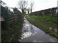
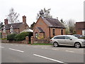
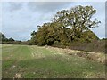
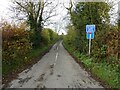
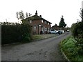
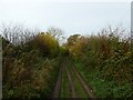
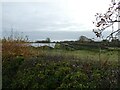
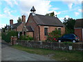
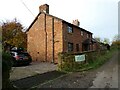
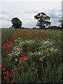
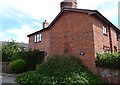
12 photos from this area
Area Information
Key information about the SY4 5SZ including its size, population, and administrative classification.
- Area Type
- Postcode
- Area Size
- 80.6 hectares
- Population
- 1745
- Population Density
- 35 people/km²
House Prices in SY4 5SZ
8
Properties
£233,917
Average Sold Price
£130,000
Lowest Price
£450,000
Highest Price
Showing 8 properties
| Address | Type | Beds | Baths | Last Sale Price | Last Sale Date | |
|---|---|---|---|---|---|---|
| The Elms, A 528 From Burlton B 4397 Junction To Wackley Junction, Burlton, Shrewsbury, SY4 5SZ | house | - | - | £450,000 | Feb 2021 | |
| The Varnall, A 528 From Burlton B 4397 Junction To Wackley Junction, Burlton, Shrewsbury, SY4 5SZ | house | - | - | £320,000 | Aug 2014 | |
| Greenfields, A 528 From Burlton B 4397 Junction To Wackley Junction, Burlton, Shrewsbury, SY4 5SZ | Detached | - | - | £195,000 | Aug 2012 | |
| Yew Tree House, A 528 From Burlton B 4397 Junction To Wackley Junction, Burlton, Shrewsbury, SY4 5SZ | Detached | 3 | 2 | £178,500 | Mar 2002 | |
| The Hawthorns, A 528 From Burlton B 4397 Junction To Wackley Junction, Burlton, Shrewsbury, SY4 5SZ | Detached | - | - | £130,000 | May 1999 | |
| Old Farm, A 528 From Burlton B 4397 Junction To Wackley Junction, Burlton, Shrewsbury, SY4 5SZ | house | - | - | £130,000 | Jun 1996 | |
| The Grove, A 528 From Burlton B 4397 Junction To Wackley Junction, Burlton, Shrewsbury, SY4 5SZ | Detached | - | - | - | - | |
| Holly Lodge, A 528 From Burlton B 4397 Junction To Wackley Junction, Burlton, Shrewsbury, SY4 5SZ | house | - | - | - | - |
Energy Efficiency in SY4 5SZ
Amenities
Schools
| Rank | School | Type | Entry gender | Ages |
|---|
Explore more schools in this area
Go to Schools tabDemographics
Household Size
Two person
most common
Accommodation Type
Houses
most common
Tenure
82
majority
Ethnic Group
White
most common
Religion
N/A
most common
Household Composition
N/A
most common
Age
47
median
Adults (30-64 years)
most common
Household Deprivation
N/A
with no deprivation
NS-SEC
37
in Lower managerial occupations
Explore more demographic insights in this area
Go to Demographics tabPlanning
Planning Constraints
- Flood RiskPremium
- Ramsar Wetland SitesPremium
- Area of Outstanding Natural BeautyPremium
- Protected Nature ReservePremium
- Protected WoodlandPremium