Area Overview for SY4 2DR
Photos of SY4 2DR

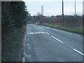
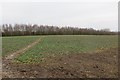
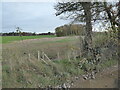
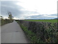
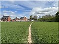
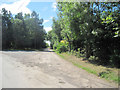

8 photos from this area
Area Information
Key information about the SY4 2DR including its size, population, and administrative classification.
- Area Type
- Postcode
- Area Size
- 8.5 hectares
- Population
- 2333
- Population Density
- 159 people/km²
House Prices in SY4 2DR
34
Properties
£360,162
Average Sold Price
£139,500
Lowest Price
£672,000
Highest Price
Showing 34 properties
| Address | Type | Beds | Baths | Last Sale Price | Last Sale Date | |
|---|---|---|---|---|---|---|
| Rose Cottage, Prescott Road, Prescott, Baschurch, SY4 2DR | house | - | - | £429,950 | Jul 2025 | |
| 42, Prescott Cottages, Prescott Road, Prescott, Baschurch, SY4 2DR | house | 3 | 1 | £260,000 | Dec 2024 | |
| Walford House, Prescott Road, Prescott, Baschurch, SY4 2DR | Detached | 4 | 2 | £485,000 | Aug 2024 | |
| Stonewalls, Prescott Road, Prescott, Baschurch, SY4 2DR | house | - | - | £672,000 | Mar 2023 | |
| Misty Dawn, Prescott Road, Prescott, Baschurch, SY4 2DR | Bungalow | - | - | £381,500 | May 2022 | |
| Poppy House, Prescott Grange Junction South To Flanders River Perry Junction, Prescott, Baschurch, SY4 2DR | house | - | - | £600,000 | Oct 2021 | |
| Corbet Lodge, Prescott Road, Prescott, Baschurch, SY4 2DR | house | - | - | £350,000 | Aug 2021 | |
| Cedar Cottage, Prescott Road, Prescott, Baschurch, SY4 2DR | house | - | - | £250,000 | Aug 2021 | |
| Woodhey, Prescott Road, Prescott, Baschurch, SY4 2DR | house | - | - | £310,000 | Nov 2020 | |
| Ivy Patch, Prescott Road, Prescott, Baschurch, SY4 2DR | Bungalow | - | - | £549,000 | Jun 2019 |
Page 1 of 4
Energy Efficiency in SY4 2DR
Amenities
Schools
| Rank | School | Type | Entry gender | Ages |
|---|
Explore more schools in this area
Go to Schools tabDemographics
Household Size
Two person
most common
Accommodation Type
Houses
most common
Tenure
78
majority
Ethnic Group
White
most common
Religion
N/A
most common
Household Composition
N/A
most common
Age
47
median
Adults (30-64 years)
most common
Household Deprivation
N/A
with no deprivation
NS-SEC
41
in Lower managerial occupations
Explore more demographic insights in this area
Go to Demographics tabPlanning
Planning Constraints
- Flood RiskPremium
- Ramsar Wetland SitesPremium
- Area of Outstanding Natural BeautyPremium
- Protected Nature ReservePremium
- Protected WoodlandPremium