Area Overview for SY4 1DE
Photos of SY4 1DE
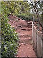
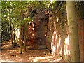
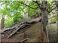
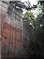
80 photos from this area
Area Information
Key information about the SY4 1DE including its size, population, and administrative classification.
- Area Type
- Postcode
- Area Size
- 1.7 hectares
- Population
- 1534
- Population Density
- 43 people/km²
House Prices in SY4 1DE
30
Properties
£144,450
Average Sold Price
£40,000
Lowest Price
£215,000
Highest Price
Showing 30 properties
| Address | Type | Beds | Baths | Last Sale Price | Last Sale Date | |
|---|---|---|---|---|---|---|
| 15 The Crescent, Nesscliffe, Shrewsbury, SY4 1DE | house | - | - | £215,000 | May 2020 | |
| 13 The Crescent, Nesscliffe, Shrewsbury, SY4 1DE | Semi-detached | 3 | 1 | £198,000 | Jul 2018 | |
| 5 The Crescent, Nesscliffe, Shrewsbury, SY4 1DE | house | 2 | 1 | £162,000 | Mar 2017 | |
| 14 The Crescent, Nesscliffe, Shrewsbury, SY4 1DE | house | - | - | £177,500 | Jul 2016 | |
| 4 The Crescent, Nesscliffe, Shrewsbury, SY4 1DE | house | - | - | £125,000 | Jun 2016 | |
| 17 The Crescent, Nesscliffe, Shrewsbury, SY4 1DE | house | - | - | £129,500 | Dec 2014 | |
| 12 The Crescent, Nesscliffe, Shrewsbury, SY4 1DE | house | 3 | - | £189,500 | Oct 2014 | |
| 3 The Crescent, Nesscliffe, Shrewsbury, SY4 1DE | house | - | - | £133,000 | Mar 2007 | |
| 8 The Crescent, Nesscliffe, Shrewsbury, SY4 1DE | Semi-detached | - | - | £75,000 | May 2002 | |
| 16 The Crescent, Nesscliffe, Shrewsbury, SY4 1DE | Detached | 3 | 1 | £40,000 | Oct 1996 |
Page 1 of 3
Energy Efficiency in SY4 1DE
Amenities
Schools
| Rank | School | Type | Entry gender | Ages |
|---|
Explore more schools in this area
Go to Schools tabDemographics
Household Size
Two person
most common
Accommodation Type
Houses
most common
Tenure
75
majority
Ethnic Group
White
most common
Religion
N/A
most common
Household Composition
N/A
most common
Age
47
median
Adults (30-64 years)
most common
Household Deprivation
N/A
with no deprivation
NS-SEC
37
in Lower managerial occupations
Explore more demographic insights in this area
Go to Demographics tabPlanning
Planning Constraints
- Flood RiskPremium
- Ramsar Wetland SitesPremium
- Area of Outstanding Natural BeautyPremium
- Protected Nature ReservePremium
- Protected WoodlandPremium