Area Overview for SY4 1AY
Photos of SY4 1AY
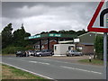
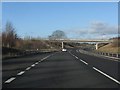
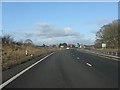
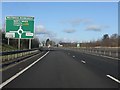
24 photos from this area
Area Information
Key information about the SY4 1AY including its size, population, and administrative classification.
- Area Type
- Postcode
- Area Size
- 1.3 km²
- Population
- 1534
- Population Density
- 43 people/km²
House Prices in SY4 1AY
17
Properties
£340,000
Average Sold Price
£130,000
Lowest Price
£730,000
Highest Price
Showing 17 properties
| Address | Type | Beds | Baths | Last Sale Price | Last Sale Date | |
|---|---|---|---|---|---|---|
| Ty Coch, Wolfshead, Access To Wolfshead, Nesscliffe, Shrewsbury, SY4 1AY | Terraced | - | - | £200,000 | Sep 2022 | |
| New Heath Farm, Gibraltar Lane, Nescliffe, Shrewsbury, SY4 1AY | house | - | - | £300,000 | Mar 2019 | |
| Treetops, The Old A 5 Through Nesscliffe, Nesscliffe, Shrewsbury, SY4 1AY | Detached | - | - | £730,000 | Jan 2016 | |
| Gate House, The Old A 5 Through Nesscliffe, Nesscliffe, Shrewsbury, SY4 1AY | house | - | - | £130,000 | Mar 2006 | |
| Wood Farm, Gibraltar Lane, Nescliffe, Shrewsbury, SY4 1AY | Detached | - | - | - | - | |
| Heath Farm, The Old A 5 Through Nesscliffe, Nesscliffe, Shrewsbury, SY4 1AY | house | 5 | 3 | - | - | |
| The Haven, The Old A 5 Through Nesscliffe, Nesscliffe, Shrewsbury, SY4 1AY | house | 5 | 2 | - | - | |
| The Old Stables, Wolfshead, Access To Wolfshead, Nesscliffe, Shrewsbury, SY4 1AY | Terraced | - | - | - | - | |
| Wolfshead Lodge, Wolfshead, Access To Wolfshead, Nesscliffe, Shrewsbury, SY4 1AY | Detached | - | - | - | - | |
| Drift Way Barn, Wolfshead, Access To Wolfshead, Nesscliffe, Shrewsbury, SY4 1AY | Terraced | - | - | - | - |
Page 1 of 2
Energy Efficiency in SY4 1AY
Amenities
Schools
| Rank | School | Type | Entry gender | Ages |
|---|
Explore more schools in this area
Go to Schools tabDemographics
Household Size
Two person
most common
Accommodation Type
Houses
most common
Tenure
75
majority
Ethnic Group
White
most common
Religion
N/A
most common
Household Composition
N/A
most common
Age
47
median
Adults (30-64 years)
most common
Household Deprivation
N/A
with no deprivation
NS-SEC
37
in Lower managerial occupations
Explore more demographic insights in this area
Go to Demographics tabPlanning
Planning Constraints
- Flood RiskPremium
- Ramsar Wetland SitesPremium
- Area of Outstanding Natural BeautyPremium
- Protected Nature ReservePremium
- Protected WoodlandPremium