Area Overview for SY3 7QX
Photos of SY3 7QX
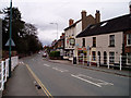


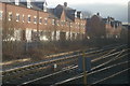
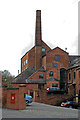


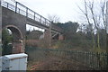
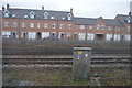
100 photos from this area
Area Information
Key information about the SY3 7QX including its size, population, and administrative classification.
- Area Type
- Postcode
- Area Size
- 1.2 hectares
- Population
- 1554
- Population Density
- 2231 people/km²
House Prices in SY3 7QX
13
Properties
£365,455
Average Sold Price
£60,000
Lowest Price
£825,000
Highest Price
Showing 13 properties
| Address | Type | Beds | Baths | Last Sale Price | Last Sale Date | |
|---|---|---|---|---|---|---|
| Whelton House, 35A Hereford Road, Belle Vue, Shrewsbury, SY3 7QX | house | - | - | £825,000 | Jul 2025 | |
| 27 Hereford Road, Belle Vue, Shrewsbury, SY3 7QX | house | 3 | 1 | £415,000 | Oct 2022 | |
| 17A Hereford Road, Belle Vue, Shrewsbury, SY3 7QX | Detached | 4 | 2 | £420,000 | Jun 2021 | |
| The Shrubbery, 35 Hereford Road, Belle Vue, Shrewsbury, SY3 7QX | house | - | - | £525,000 | Oct 2019 | |
| Brook House, 33 Hereford Road, Belle Vue, Shrewsbury, SY3 7QX | Detached | 5 | 3 | £690,000 | Jul 2019 | |
| 21 Hereford Road, Belle Vue, Shrewsbury, SY3 7QX | Detached | 2 | 1 | £240,000 | Sep 2011 | |
| 23 Hereford Road, Belle Vue, Shrewsbury, SY3 7QX | house | - | - | £215,000 | Oct 2010 | |
| 19 Hereford Road, Belle Vue, Shrewsbury, SY3 7QX | Detached | - | - | £235,000 | May 2008 | |
| 25 Hereford Road, Belle Vue, Shrewsbury, SY3 7QX | Semi-detached | - | - | £240,000 | Feb 2007 | |
| 17 Hereford Road, Belle Vue, Shrewsbury, SY3 7QX | Detached | - | - | £155,000 | Jun 2001 |
Page 1 of 2
Energy Efficiency in SY3 7QX
Amenities
Schools
| Rank | School | Type | Entry gender | Ages |
|---|
Explore more schools in this area
Go to Schools tabDemographics
Household Size
Family (3-5 people)
most common
Accommodation Type
Houses
most common
Tenure
79
majority
Ethnic Group
White
most common
Religion
N/A
most common
Household Composition
N/A
most common
Age
47
median
Adults (30-64 years)
most common
Household Deprivation
N/A
with no deprivation
NS-SEC
41
in Lower managerial occupations
Explore more demographic insights in this area
Go to Demographics tabPlanning
Planning Constraints
- Flood RiskPremium
- Ramsar Wetland SitesPremium
- Area of Outstanding Natural BeautyPremium
- Protected Nature ReservePremium
- Protected WoodlandPremium