Area Overview for SY2 6EN
Photos of SY2 6EN

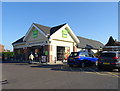
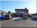
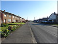
58 photos from this area
Area Information
Key information about the SY2 6EN including its size, population, and administrative classification.
- Area Type
- Postcode
- Area Size
- 4715 m²
- Population
- 1380
- Population Density
- 1253 people/km²
House Prices in SY2 6EN
14
Properties
£145,363
Average Sold Price
£54,000
Lowest Price
£202,500
Highest Price
Showing 14 properties
| Address | Type | Beds | Baths | Last Sale Price | Last Sale Date | |
|---|---|---|---|---|---|---|
| 67 Pool Rise, Shrewsbury, SY2 6EN | house | - | - | £185,000 | Nov 2023 | |
| 71 Pool Rise, Shrewsbury, SY2 6EN | house | 2 | - | £202,500 | Mar 2023 | |
| 61 Pool Rise, Shrewsbury, SY2 6EN | house | - | - | £139,950 | Jan 2015 | |
| 81 Pool Rise, Shrewsbury, SY2 6EN | Semi-detached | - | - | £54,000 | Mar 2001 | |
| 55 Pool Rise, Shrewsbury, SY2 6EN | Semi-detached | 2 | 1 | - | - | |
| 77 Pool Rise, Shrewsbury, SY2 6EN | house | - | - | - | - | |
| 65 Pool Rise, Shrewsbury, SY2 6EN | Semi-detached | - | - | - | - | |
| 57 Pool Rise, Shrewsbury, SY2 6EN | house | - | - | - | - | |
| 63 Pool Rise, Shrewsbury, SY2 6EN | house | - | - | - | - | |
| 69 Pool Rise, Shrewsbury, SY2 6EN | Semi-detached | - | - | - | - |
Page 1 of 2
Energy Efficiency in SY2 6EN
Amenities
Schools
| Rank | School | Type | Entry gender | Ages |
|---|
Explore more schools in this area
Go to Schools tabDemographics
Household Size
Two person
most common
Accommodation Type
Houses
most common
Tenure
67
majority
Ethnic Group
White
most common
Religion
N/A
most common
Household Composition
N/A
most common
Age
47
median
Adults (30-64 years)
most common
Household Deprivation
N/A
with no deprivation
NS-SEC
31
in Lower managerial occupations
Explore more demographic insights in this area
Go to Demographics tabPlanning
Planning Constraints
- Flood RiskPremium
- Ramsar Wetland SitesPremium
- Area of Outstanding Natural BeautyPremium
- Protected Nature ReservePremium
- Protected WoodlandPremium