Area Overview for SY2 6AF
Photos of SY2 6AF

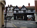
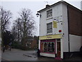
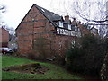
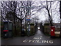
100 photos from this area
Area Information
Key information about the SY2 6AF including its size, population, and administrative classification.
- Area Type
- Postcode
- Area Size
- 1.2 hectares
- Population
- 1362
- Population Density
- 3256 people/km²
House Prices in SY2 6AF
18
Properties
£404,167
Average Sold Price
£320,000
Lowest Price
£650,000
Highest Price
Showing 18 properties
| Address | Type | Beds | Baths | Last Sale Price | Last Sale Date | |
|---|---|---|---|---|---|---|
| 11 Amber Rise, The Old Meadow, Shrewsbury, SY2 6AF | house | - | - | £460,000 | May 2024 | |
| 18 Amber Rise, The Old Meadow, Shrewsbury, SY2 6AF | house | - | - | £650,000 | Dec 2022 | |
| 15 Amber Rise, The Old Meadow, Shrewsbury, SY2 6AF | house | 4 | 3 | £465,000 | May 2022 | |
| 17 Amber Rise, The Old Meadow, Shrewsbury, SY2 6AF | house | - | - | £555,000 | Dec 2020 | |
| 9 Amber Rise, The Old Meadow, Shrewsbury, SY2 6AF | Terraced | 4 | 5 | £435,000 | Oct 2020 | |
| 8 Amber Rise, The Old Meadow, Shrewsbury, SY2 6AF | Terraced | 4 | 5 | £442,000 | Dec 2019 | |
| 1 Amber Rise, The Old Meadow, Shrewsbury, SY2 6AF | house | - | - | £425,000 | Jun 2019 | |
| 10 Amber Rise, The Old Meadow, Shrewsbury, SY2 6AF | house | - | - | £400,000 | May 2017 | |
| 2 Amber Rise, The Old Meadow, Shrewsbury, SY2 6AF | house | - | - | £365,000 | Jan 2016 | |
| 5 Amber Rise, The Old Meadow, Shrewsbury, SY2 6AF | house | - | - | £365,000 | Dec 2015 |
Page 1 of 2
Energy Efficiency in SY2 6AF
Amenities
Schools
| Rank | School | Type | Entry gender | Ages |
|---|
Explore more schools in this area
Go to Schools tabDemographics
Household Size
One person
most common
Accommodation Type
Houses
most common
Tenure
61
majority
Ethnic Group
White
most common
Religion
N/A
most common
Household Composition
N/A
most common
Age
47
median
Adults (30-64 years)
most common
Household Deprivation
N/A
with no deprivation
NS-SEC
46
in Lower managerial occupations
Explore more demographic insights in this area
Go to Demographics tabPlanning
Planning Constraints
- Flood RiskPremium
- Ramsar Wetland SitesPremium
- Area of Outstanding Natural BeautyPremium
- Protected Nature ReservePremium
- Protected WoodlandPremium