Area Overview for SY2 6AD
Photos of SY2 6AD
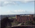
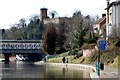
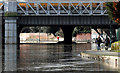
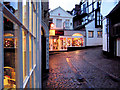
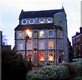
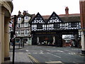
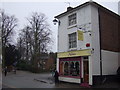
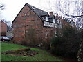
100 photos from this area
Area Information
Key information about the SY2 6AD including its size, population, and administrative classification.
- Area Type
- Postcode
- Area Size
- 4621 m²
- Population
- 1009
- Population Density
- 4793 people/km²
House Prices in SY2 6AD
8
Properties
£121,000
Average Sold Price
£112,000
Lowest Price
£130,000
Highest Price
Showing 8 properties
| Address | Type | Beds | Baths | Last Sale Price | Last Sale Date | |
|---|---|---|---|---|---|---|
| 5 Abbey Foregate, Shrewsbury, SY2 6AD | Terraced | 2 | 2 | £130,000 | Apr 2023 | |
| 6 Abbey Foregate, Shrewsbury, SY2 6AD | Terraced | 3 | 2 | £112,000 | Jan 2006 | |
| The Shed, Ground Floor Takeaway At, 7 Abbey Foregate, Shrewsbury, SY2 6AD | Restaurant | - | - | - | - | |
| Flat 2, 8 Abbey Foregate, Shrewsbury, SY2 6AD | Flat | - | - | - | - | |
| Third Floor Flat At, 7 Abbey Foregate, Shrewsbury, SY2 6AD | Flat | - | - | - | - | |
| 7 Abbey Foregate, Shrewsbury, SY2 6AD | house | - | - | - | - | |
| English Bridge Workshop, Abbey Foregate, Shrewsbury, SY2 6AD | office_workshop | - | - | - | - | |
| Flat 1, 8 Abbey Foregate, Shrewsbury, SY2 6AD | Flat | - | - | - | - |
Energy Efficiency in SY2 6AD
Amenities
Schools
| Rank | School | Type | Entry gender | Ages |
|---|
Explore more schools in this area
Go to Schools tabDemographics
Household Size
One person
most common
Accommodation Type
Flats
most common
Tenure
45
majority
Ethnic Group
White
most common
Religion
N/A
most common
Household Composition
N/A
most common
Age
47
median
Elderly (65+ years)
most common
Household Deprivation
N/A
with no deprivation
NS-SEC
39
in Lower managerial occupations
Explore more demographic insights in this area
Go to Demographics tabPlanning
Planning Constraints
- Flood RiskPremium
- Ramsar Wetland SitesPremium
- Area of Outstanding Natural BeautyPremium
- Protected Nature ReservePremium
- Protected WoodlandPremium