Area Overview for SY2 5SS
Photos of SY2 5SS
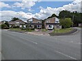
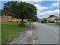
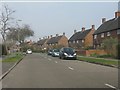
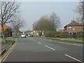
17 photos from this area
Area Information
Key information about the SY2 5SS including its size, population, and administrative classification.
- Area Type
- Postcode
- Area Size
- 4847 m²
- Population
- 1369
- Population Density
- 2098 people/km²
House Prices in SY2 5SS
13
Properties
£146,000
Average Sold Price
£85,000
Lowest Price
£244,000
Highest Price
Showing 13 properties
| Address | Type | Beds | Baths | Last Sale Price | Last Sale Date | |
|---|---|---|---|---|---|---|
| 263A Monkmoor Road, Shrewsbury, SY2 5SS | Semi-detached | 3 | 2 | £175,000 | Jul 2022 | |
| 267 Monkmoor Road, Shrewsbury, SY2 5SS | Semi-detached | 3 | 1 | £244,000 | Jan 2021 | |
| 263B Monkmoor Road, Shrewsbury, SY2 5SS | Semi-detached | 2 | 1 | £143,000 | Sep 2017 | |
| 279 Monkmoor Road, Shrewsbury, SY2 5SS | house | - | - | £135,000 | Mar 2015 | |
| 273 Monkmoor Road, Shrewsbury, SY2 5SS | Terraced | - | - | £105,000 | Feb 2013 | |
| 275 Monkmoor Road, Shrewsbury, SY2 5SS | Retail | 3 | 1 | £135,000 | Mar 2007 | |
| 265 Monkmoor Road, Shrewsbury, SY2 5SS | Semi-detached | 3 | 2 | £85,000 | Jul 2003 | |
| 267A Monkmoor Road, Shrewsbury, SY2 5SS | Terraced | 2 | 1 | - | - | |
| 277 Monkmoor Road, Shrewsbury, SY2 5SS | Terraced | 2 | 1 | - | - | |
| 269 Monkmoor Road, Shrewsbury, SY2 5SS | Terraced | - | - | - | - |
Page 1 of 2
Energy Efficiency in SY2 5SS
Amenities
Schools
| Rank | School | Type | Entry gender | Ages |
|---|
Explore more schools in this area
Go to Schools tabDemographics
Household Size
Two person
most common
Accommodation Type
Houses
most common
Tenure
62
majority
Ethnic Group
White
most common
Religion
N/A
most common
Household Composition
N/A
most common
Age
47
median
Adults (30-64 years)
most common
Household Deprivation
N/A
with no deprivation
NS-SEC
22
in Lower managerial occupations
Explore more demographic insights in this area
Go to Demographics tabPlanning
Planning Constraints
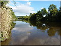
- Flood RiskPremium
- Ramsar Wetland SitesPremium
- Area of Outstanding Natural BeautyPremium
- Protected Nature ReservePremium
- Protected WoodlandPremium