Area Overview for SY2 5NJ
Photos of SY2 5NJ
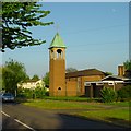
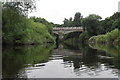
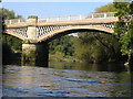
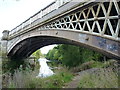
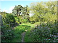
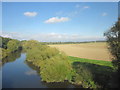
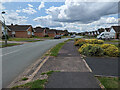
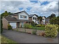
34 photos from this area
Area Information
Key information about the SY2 5NJ including its size, population, and administrative classification.
- Area Type
- Postcode
- Area Size
- 2.9 hectares
- Population
- 1711
- Population Density
- 1422 people/km²
House Prices in SY2 5NJ
23
Properties
£195,732
Average Sold Price
£35,000
Lowest Price
£302,500
Highest Price
Showing 23 properties
| Address | Type | Beds | Baths | Last Sale Price | Last Sale Date | |
|---|---|---|---|---|---|---|
| 54 Portland Crescent, Shrewsbury, SY2 5NJ | Bungalow | - | - | £293,000 | Nov 2022 | |
| 43 Portland Crescent, Shrewsbury, SY2 5NJ | Bungalow | - | - | £300,000 | Jun 2021 | |
| 41 Portland Crescent, Shrewsbury, SY2 5NJ | Bungalow | - | - | £302,500 | May 2021 | |
| 55 Portland Crescent, Shrewsbury, SY2 5NJ | Bungalow | 3 | 1 | £257,500 | Aug 2020 | |
| 33 Portland Crescent, Shrewsbury, SY2 5NJ | Bungalow | - | - | £190,000 | May 2017 | |
| 31 Portland Crescent, Shrewsbury, SY2 5NJ | Bungalow | - | - | £187,000 | Dec 2016 | |
| 58 Portland Crescent, Shrewsbury, SY2 5NJ | house | - | - | £250,000 | Jun 2014 | |
| 47 Portland Crescent, Shrewsbury, SY2 5NJ | house | - | - | £230,000 | Jun 2014 | |
| 56 Portland Crescent, Shrewsbury, SY2 5NJ | Bungalow | - | - | £180,000 | Aug 2010 | |
| 60 Portland Crescent, Shrewsbury, SY2 5NJ | Detached | 4 | 1 | £240,000 | Aug 2006 |
Page 1 of 3
Energy Efficiency in SY2 5NJ
Amenities
Schools
| Rank | School | Type | Entry gender | Ages |
|---|
Explore more schools in this area
Go to Schools tabDemographics
Household Size
Two person
most common
Accommodation Type
Houses
most common
Tenure
90
majority
Ethnic Group
White
most common
Religion
N/A
most common
Household Composition
N/A
most common
Age
47
median
Adults (30-64 years)
most common
Household Deprivation
N/A
with no deprivation
NS-SEC
42
in Lower managerial occupations
Explore more demographic insights in this area
Go to Demographics tabPlanning
Planning Constraints
- Flood RiskPremium
- Ramsar Wetland SitesPremium
- Area of Outstanding Natural BeautyPremium
- Protected Nature ReservePremium
- Protected WoodlandPremium