Area Overview for SY2 5HX
Photos of SY2 5HX

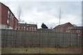
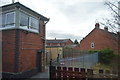
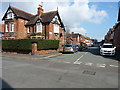
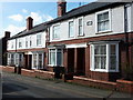
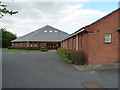
100 photos from this area
Area Information
Key information about the SY2 5HX including its size, population, and administrative classification.
- Area Type
- Postcode
- Area Size
- 9515 m²
- Population
- 1615
- Population Density
- 4937 people/km²
House Prices in SY2 5HX
24
Properties
£210,700
Average Sold Price
£100,000
Lowest Price
£385,000
Highest Price
Showing 24 properties
| Address | Type | Beds | Baths | Last Sale Price | Last Sale Date | |
|---|---|---|---|---|---|---|
| 30 Crowmere Road, Shrewsbury, SY2 5HX | house | - | - | £385,000 | Aug 2023 | |
| 75 Crowmere Road, Shrewsbury, SY2 5HX | house | - | - | £170,000 | Feb 2023 | |
| 24 Crowmere Road, Shrewsbury, SY2 5HX | house | 3 | 1 | £230,000 | Oct 2022 | |
| 73 Crowmere Road, Shrewsbury, SY2 5HX | Terraced | 3 | 2 | £248,000 | Aug 2022 | |
| 42 Crowmere Road, Shrewsbury, SY2 5HX | house | - | - | £187,000 | Dec 2020 | |
| 77 Crowmere Road, Shrewsbury, SY2 5HX | Terraced | 2 | 1 | £172,000 | Dec 2019 | |
| 28 Crowmere Road, Shrewsbury, SY2 5HX | house | - | - | £250,000 | Oct 2016 | |
| 79 Crowmere Road, Shrewsbury, SY2 5HX | Terraced | 2 | 1 | £169,995 | Aug 2014 | |
| 26A Crowmere Road, Shrewsbury, SY2 5HX | house | - | - | £195,000 | Feb 2010 | |
| 36 Crowmere Road, Shrewsbury, SY2 5HX | house | - | - | £100,000 | Apr 2003 |
Page 1 of 3
Energy Efficiency in SY2 5HX
Amenities
Schools
| Rank | School | Type | Entry gender | Ages |
|---|
Explore more schools in this area
Go to Schools tabDemographics
Household Size
Two person
most common
Accommodation Type
Houses
most common
Tenure
70
majority
Ethnic Group
White
most common
Religion
N/A
most common
Household Composition
N/A
most common
Age
47
median
Adults (30-64 years)
most common
Household Deprivation
N/A
with no deprivation
NS-SEC
35
in Lower managerial occupations
Explore more demographic insights in this area
Go to Demographics tabPlanning
Planning Constraints
- Flood RiskPremium
- Ramsar Wetland SitesPremium
- Area of Outstanding Natural BeautyPremium
- Protected Nature ReservePremium
- Protected WoodlandPremium