Area Overview for SY13 3AA
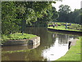
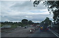
Photos of SY13 3AA

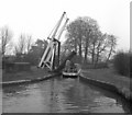
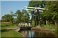
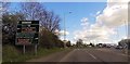
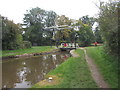
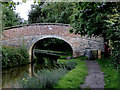
![New Mills Liftbridge [No 31], from the north in SY13 3AA](https://images.propbar.co.uk/images/geograph/52/18/5218333_120.jpg)
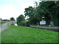
84 photos from this area
Area Information
Key information about the SY13 3AA including its size, population, and administrative classification.
- Area Type
- Postcode
- Area Size
- 38.8 hectares
- Population
- 1808
- Population Density
- 179 people/km²
House Prices in SY13 3AA
5
Properties
£220,000
Average Sold Price
£220,000
Lowest Price
£220,000
Highest Price
Showing 5 properties
| Address | Type | Beds | Baths | Last Sale Price | Last Sale Date | |
|---|---|---|---|---|---|---|
| Bridge House, Wrexham Road, Hadley, Whitchurch, SY13 3AA | Detached | 4 | - | £220,000 | Dec 2002 | |
| Duck Narrowboat, Whitchurch Marina, Wrexham Road, Hadley, Whitchurch, SY13 3AA | Houseboat | - | - | - | - | |
| Whitchurch Marina, Wrexham Road, Hadley, Whitchurch, SY13 3AA | Leisure | - | - | - | - | |
| Narrow Boat Vicky, Whitchurch Marina, Wrexham Road, Hadley, Whitchurch, SY13 3AA | Houseboat | - | - | - | - | |
| Narrowboat Gandalf, Whitchurch Marina, Wrexham Road, Hadley, Whitchurch, SY13 3AA | Houseboat | - | - | - | - |
Energy Efficiency in SY13 3AA
Amenities
Schools
| Rank | School | Type | Entry gender | Ages |
|---|
Explore more schools in this area
Go to Schools tabDemographics
Household Size
Two person
most common
Accommodation Type
Houses
most common
Tenure
87
majority
Ethnic Group
White
most common
Religion
N/A
most common
Household Composition
N/A
most common
Age
47
median
Adults (30-64 years)
most common
Household Deprivation
N/A
with no deprivation
NS-SEC
39
in Lower managerial occupations
Explore more demographic insights in this area
Go to Demographics tabPlanning
Planning Constraints
- Flood RiskPremium
- Ramsar Wetland SitesPremium
- Area of Outstanding Natural BeautyPremium
- Protected Nature ReservePremium
- Protected WoodlandPremium