Area Overview for SY13 1NR
Photos of SY13 1NR
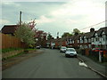
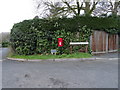
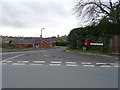
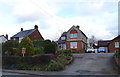
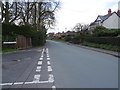
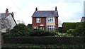
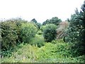
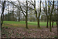
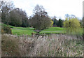
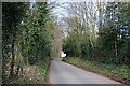
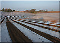
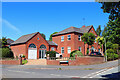
14 photos from this area
Area Information
Key information about the SY13 1NR including its size, population, and administrative classification.
- Area Type
- Postcode
- Area Size
- 3.4 hectares
- Population
- 1808
- Population Density
- 179 people/km²
House Prices in SY13 1NR
18
Properties
£304,042
Average Sold Price
£100,000
Lowest Price
£550,000
Highest Price
Showing 18 properties
| Address | Type | Beds | Baths | Last Sale Price | Last Sale Date | |
|---|---|---|---|---|---|---|
| The Cottage, Alport Road, Whitchurch, SY13 1NR | house | - | - | £548,000 | Jun 2025 | |
| Alport Barn, Alport Road, Whitchurch, SY13 1NR | house | - | - | £530,000 | Jun 2021 | |
| Hillcrest, Alport Road, Whitchurch, SY13 1NR | Bungalow | 2 | 2 | £275,000 | Aug 2020 | |
| Byways, Alport Road, Whitchurch, SY13 1NR | Detached | 3 | 1 | £262,500 | Jul 2020 | |
| Alport Farm House, Alport Road, Whitchurch, SY13 1NR | Detached | 5 | 3 | £550,000 | Dec 2016 | |
| Withinlee, Alport Road, Whitchurch, SY13 1NR | Detached | 4 | 2 | £318,000 | Apr 2016 | |
| Sheldon Oak, Alport Road, Whitchurch, SY13 1NR | Bungalow | - | - | £290,000 | Mar 2010 | |
| 54 Alport Road, Whitchurch, SY13 1NR | Detached | 3 | 1 | £250,000 | May 2005 | |
| The Stables, Alport Road, Whitchurch, SY13 1NR | Detached | 3 | 1 | £242,000 | May 2004 | |
| Lyndhurst, Alport Road, Whitchurch, SY13 1NR | Detached | - | - | £140,000 | Aug 1998 |
Page 1 of 2
Energy Efficiency in SY13 1NR
Amenities
Schools
| Rank | School | Type | Entry gender | Ages |
|---|
Explore more schools in this area
Go to Schools tabDemographics
Household Size
Two person
most common
Accommodation Type
Houses
most common
Tenure
87
majority
Ethnic Group
White
most common
Religion
N/A
most common
Household Composition
N/A
most common
Age
47
median
Adults (30-64 years)
most common
Household Deprivation
N/A
with no deprivation
NS-SEC
39
in Lower managerial occupations
Explore more demographic insights in this area
Go to Demographics tabPlanning
Planning Constraints
- Flood RiskPremium
- Ramsar Wetland SitesPremium
- Area of Outstanding Natural BeautyPremium
- Protected Nature ReservePremium
- Protected WoodlandPremium