Area Overview for SY12 9AA
Photos of SY12 9AA
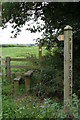
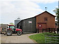
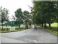

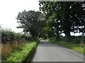
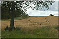
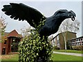
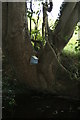
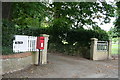
9 photos from this area
Area Information
Key information about the SY12 9AA including its size, population, and administrative classification.
- Area Type
- Postcode
- Area Size
- 71.2 hectares
- Population
- 1584
- Population Density
- 29 people/km²
House Prices in SY12 9AA
24
Properties
£283,667
Average Sold Price
£150,000
Lowest Price
£465,000
Highest Price
Showing 24 properties
| Address | Type | Beds | Baths | Last Sale Price | Last Sale Date | |
|---|---|---|---|---|---|---|
| Sandycroft, Birch Road, Ellesmere, SY12 9AA | house | - | - | £465,000 | Jun 2021 | |
| Grantchester, Birch Road, Ellesmere, SY12 9AA | house | - | - | £150,000 | Jan 2012 | |
| Blackwater Cottage, Birch Road, Ellesmere, SY12 9AA | Detached | - | - | £236,000 | Dec 2003 | |
| 3, Redbridge House, The Gardens, Birch Road, Ellesmere, SY12 9AA | Detached | 4 | 3 | - | - | |
| 1, The Gardens, Birch Road, Ellesmere, SY12 9AA | Detached | 4 | 2 | - | - | |
| 5, Beech House, Birch Road, Ellesmere, SY12 9AA | Semi-detached | 5 | 4 | - | - | |
| 4, Beech House, Birch Road, Ellesmere, SY12 9AA | Detached | 4 | 2 | - | - | |
| 6, Beech House, Birch Road, Ellesmere, SY12 9AA | Semi-detached | 5 | 4 | - | - | |
| British Waterways, Birch Road, Ellesmere, SY12 9AA | Industrial | - | - | - | - | |
| Birch Hall, Ellesmere Road End Of To Start Of Birch Road, Tetchill, SY12 9AA | house | - | - | - | - |
Page 1 of 3
Energy Efficiency in SY12 9AA
Amenities
Schools
| Rank | School | Type | Entry gender | Ages |
|---|
Explore more schools in this area
Go to Schools tabDemographics
Household Size
Two person
most common
Accommodation Type
Houses
most common
Tenure
78
majority
Ethnic Group
White
most common
Religion
N/A
most common
Household Composition
N/A
most common
Age
47
median
Adults (30-64 years)
most common
Household Deprivation
N/A
with no deprivation
NS-SEC
41
in Lower managerial occupations
Explore more demographic insights in this area
Go to Demographics tabPlanning
Planning Constraints
- Flood RiskPremium
- Ramsar Wetland SitesPremium
- Area of Outstanding Natural BeautyPremium
- Protected Nature ReservePremium
- Protected WoodlandPremium