Area Overview for SY12 0QR
Photos of SY12 0QR
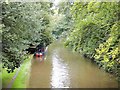

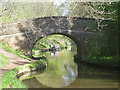
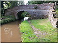

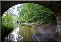
![Little Mill Bridge [No 55], from the north in SY12 0QR](https://images.propbar.co.uk/images/geograph/52/13/5213122_120.jpg)
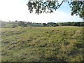
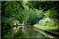
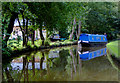
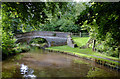
46 photos from this area
Area Information
Key information about the SY12 0QR including its size, population, and administrative classification.
- Area Type
- Postcode
- Area Size
- 1.3 km²
- Population
- 1584
- Population Density
- 29 people/km²
House Prices in SY12 0QR
4
Properties
£342,333
Average Sold Price
£102,000
Lowest Price
£745,000
Highest Price
Showing 4 properties
| Address | Type | Beds | Baths | Last Sale Price | Last Sale Date | |
|---|---|---|---|---|---|---|
| The Lime Kiln Keepers Cottage, Colemere Farm Junction With A 528 To Hampton Moss Junction, Colemere, Ellesmere, SY12 0QR | house | - | - | £180,000 | Aug 2025 | |
| Little Mill Cottage, Colemere Junction Belgrave Cottages To The Avenue, Colemere, Ellesmere, SY12 0QR | house | 3 | - | £745,000 | Sep 2020 | |
| Waters Edge, Colemere Farm Junction With A 528 To Hampton Moss Junction, Colemere, Ellesmere, SY12 0QR | Detached | - | - | £102,000 | Dec 2005 | |
| The Cabin, Colemere Farm Junction With A 528 To Hampton Moss Junction, Colemere, Ellesmere, SY12 0QR | Detached | - | - | - | - |
Energy Efficiency in SY12 0QR
Amenities
Schools
| Rank | School | Type | Entry gender | Ages |
|---|
Explore more schools in this area
Go to Schools tabDemographics
Household Size
Two person
most common
Accommodation Type
Houses
most common
Tenure
78
majority
Ethnic Group
White
most common
Religion
N/A
most common
Household Composition
N/A
most common
Age
47
median
Adults (30-64 years)
most common
Household Deprivation
N/A
with no deprivation
NS-SEC
41
in Lower managerial occupations
Explore more demographic insights in this area
Go to Demographics tabPlanning
Planning Constraints
- Flood RiskPremium
- Ramsar Wetland SitesPremium
- Area of Outstanding Natural BeautyPremium
- Protected Nature ReservePremium
- Protected WoodlandPremium