Area Overview for SY11 3JE
Photos of SY11 3JE
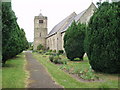
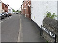
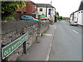


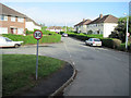

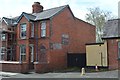
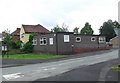
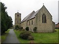
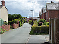
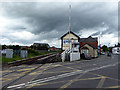
100 photos from this area
Area Information
Key information about the SY11 3JE including its size, population, and administrative classification.
- Area Type
- Postcode
- Area Size
- 6396 m²
- Population
- 1455
- Population Density
- 3476 people/km²
House Prices in SY11 3JE
15
Properties
£189,569
Average Sold Price
£79,950
Lowest Price
£485,000
Highest Price
Showing 15 properties
| Address | Type | Beds | Baths | Last Sale Price | Last Sale Date | |
|---|---|---|---|---|---|---|
| 2 Old Whittington Road, Gobowen, SY11 3JE | Terraced | 2 | 2 | £108,000 | Feb 2025 | |
| 3 Old Whittington Road, Gobowen, SY11 3JE | house | - | - | £88,000 | Aug 2023 | |
| Rockmead, Old Whittington Road, Gobowen, SY11 3JE | Semi-detached | 3 | 1 | £225,000 | Jul 2023 | |
| Brookland, Old Whittington Road, Gobowen, SY11 3JE | Detached | 6 | 3 | £485,000 | Jul 2022 | |
| Ty Camer, Old Whittington Road, Gobowen, SY11 3JE | Semi-detached | 3 | 1 | £161,000 | Sep 2019 | |
| Rosemead, Old Whittington Road, Gobowen, SY11 3JE | house | 3 | 1 | £165,450 | Apr 2019 | |
| Dyffryn, Old Whittington Road, Gobowen, SY11 3JE | house | - | - | £185,000 | Sep 2016 | |
| Endon, Old Whittington Road, Gobowen, SY11 3JE | Bungalow | - | - | £190,000 | Sep 2015 | |
| Rose Villa, Old Whittington Road, Gobowen, SY11 3JE | house | - | - | £110,000 | Jan 2014 | |
| Goodison, Old Whittington Road, Gobowen, SY11 3JE | Semi-detached | 3 | 1 | £142,000 | Nov 2010 |
Page 1 of 2
Energy Efficiency in SY11 3JE
Amenities
Schools
| Rank | School | Type | Entry gender | Ages |
|---|
Explore more schools in this area
Go to Schools tabDemographics
Household Size
Two person
most common
Accommodation Type
Houses
most common
Tenure
47
majority
Ethnic Group
White
most common
Religion
N/A
most common
Household Composition
N/A
most common
Age
47
median
Adults (30-64 years)
most common
Household Deprivation
N/A
with no deprivation
NS-SEC
24
in Lower managerial occupations
Explore more demographic insights in this area
Go to Demographics tabPlanning
Planning Constraints
- Flood RiskPremium
- Ramsar Wetland SitesPremium
- Area of Outstanding Natural BeautyPremium
- Protected Nature ReservePremium
- Protected WoodlandPremium