Area Overview for SY10 9DZ
Photos of SY10 9DZ
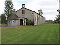
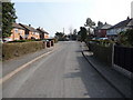
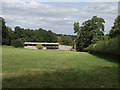
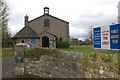
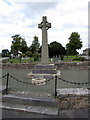
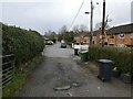
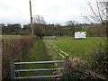
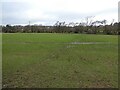
31 photos from this area
Area Information
Key information about the SY10 9DZ including its size, population, and administrative classification.
- Area Type
- Postcode
- Area Size
- 15.2 hectares
- Population
- 1600
- Population Density
- 60 people/km²
House Prices in SY10 9DZ
24
Properties
£241,458
Average Sold Price
£59,950
Lowest Price
£460,000
Highest Price
Showing 24 properties
| Address | Type | Beds | Baths | Last Sale Price | Last Sale Date | |
|---|---|---|---|---|---|---|
| Cross House, Treflach Road, Trefonen, SY10 9DZ | house | 3 | 2 | £360,000 | Sep 2025 | |
| Larkrise, Treflach Road, Trefonen, SY10 9DZ | house | - | - | £460,000 | Oct 2022 | |
| Cross Cottage, Treflach Road, Trefonen, SY10 9DZ | Flat | - | - | £212,000 | Jan 2022 | |
| Glenthorne, Treflach Road, Trefonen, SY10 9DZ | Detached | 5 | 2 | £437,000 | Mar 2021 | |
| Cornerways, Martins Fields, Trefonen, SY10 9DZ | Bungalow | 2 | 1 | £160,000 | Apr 2020 | |
| Harebells, Treflach Road, Trefonen, SY10 9DZ | Bungalow | - | - | £210,000 | Nov 2016 | |
| Trefonen Cottage, Treflach Road, Trefonen, SY10 9DZ | Detached | 5 | 2 | £362,500 | Feb 2016 | |
| Bridge View, Treflach Road, Trefonen, SY10 9DZ | house | - | - | £172,500 | Dec 2009 | |
| Darleen, Treflach Road, Trefonen, SY10 9DZ | Bungalow | - | - | £175,000 | Nov 2009 | |
| Dyffryn, Treflach Road, Trefonen, SY10 9DZ | Detached | - | - | £185,000 | Feb 2009 |
Page 1 of 3
Energy Efficiency in SY10 9DZ
Amenities
Schools
| Rank | School | Type | Entry gender | Ages |
|---|
Explore more schools in this area
Go to Schools tabDemographics
Household Size
Two person
most common
Accommodation Type
Houses
most common
Tenure
84
majority
Ethnic Group
White
most common
Religion
N/A
most common
Household Composition
N/A
most common
Age
47
median
Adults (30-64 years)
most common
Household Deprivation
N/A
with no deprivation
NS-SEC
41
in Lower managerial occupations
Explore more demographic insights in this area
Go to Demographics tabPlanning
Planning Constraints
- Flood RiskPremium
- Ramsar Wetland SitesPremium
- Area of Outstanding Natural BeautyPremium
- Protected Nature ReservePremium
- Protected WoodlandPremium