Area Overview for SY10 8NN
Photos of SY10 8NN
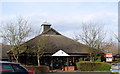

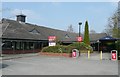


37 photos from this area
Area Information
Key information about the SY10 8NN including its size, population, and administrative classification.
- Area Type
- Postcode
- Area Size
- 30.7 hectares
- Population
- 1708
- Population Density
- 1401 people/km²
House Prices in SY10 8NN
14
Properties
-
Average Sold Price
-
Lowest Price
-
Highest Price
Showing 14 properties
| Address | Type | Beds | Baths | Last Sale Price | Last Sale Date | |
|---|---|---|---|---|---|---|
| Skyjack Uk Ltd, Unit 4, Oswestry Trade Centre, Maes Y Clawdd, Oswestry, SY10 8NN | general_industrial | - | - | - | - | |
| Skyjack Uk Ltd, Unit 2, Oswestry Trade Centre, Maes Y Clawdd, Oswestry, SY10 8NN | storage_distribution | - | - | - | - | |
| Whitbread Group Plc, Oswalds Cross, Maes Y Clawdd, Oswestry, SY10 8NN | Leisure | - | - | - | - | |
| The Managers Flat, Oswalds Cross, Maes Y Clawdd, Oswestry, SY10 8NN | Flat | - | - | - | - | |
| Flat 2, Oswalds Cross, Maes Y Clawdd, Oswestry, SY10 8NN | Flat | - | - | - | - | |
| Skyjack Uk Ltd, Unit 3, Oswestry Trade Centre, Maes Y Clawdd, Oswestry, SY10 8NN | warehouse | - | - | - | - | |
| Starbucks, Cafe, Maes Y Clawdd, Oswestry, SY10 8NN | restaurant_cafe | - | - | - | - | |
| Kfc, Restaurant, Maes Y Clawdd, Oswestry, SY10 8NN | restaurant_cafe | - | - | - | - | |
| Flat 1, Oswalds Cross, Maes Y Clawdd, Oswestry, SY10 8NN | Flat | - | - | - | - | |
| Premier Inn, Maes Y Clawdd, Oswestry, SY10 8NN | hotel | - | - | - | - |
Page 1 of 2
Energy Efficiency in SY10 8NN
Amenities
Schools
| Rank | School | Type | Entry gender | Ages |
|---|
Explore more schools in this area
Go to Schools tabDemographics
Household Size
Family (3-5 people)
most common
Accommodation Type
Houses
most common
Tenure
64
majority
Ethnic Group
White
most common
Religion
N/A
most common
Household Composition
N/A
most common
Age
47
median
Adults (30-64 years)
most common
Household Deprivation
N/A
with no deprivation
NS-SEC
24
in Lower managerial occupations
Explore more demographic insights in this area
Go to Demographics tabPlanning
Planning Constraints
- Flood RiskPremium
- Ramsar Wetland SitesPremium
- Area of Outstanding Natural BeautyPremium
- Protected Nature ReservePremium
- Protected WoodlandPremium