Area Overview for SY10 7PN
Photos of SY10 7PN
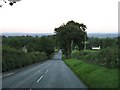
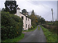
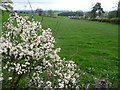
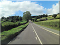
5 photos from this area
Area Information
Key information about the SY10 7PN including its size, population, and administrative classification.
- Area Type
- Postcode
- Area Size
- 64.3 hectares
- Population
- 1472
- Population Density
- 544 people/km²
House Prices in SY10 7PN
9
Properties
£435,000
Average Sold Price
£185,000
Lowest Price
£875,000
Highest Price
Showing 9 properties
| Address | Type | Beds | Baths | Last Sale Price | Last Sale Date | |
|---|---|---|---|---|---|---|
| Underhill House, Underhill Farm Junction With B 4580 To Underhill, Oswestry, SY10 7PN | Detached | 5 | 2 | £875,000 | Aug 2018 | |
| Underhill Farm, Racecourse Road, Oswestry, SY10 7PN | Detached | - | - | £245,000 | Jul 2004 | |
| Underhill Cottage, Racecourse Road, Oswestry, SY10 7PN | Bungalow | - | - | £185,000 | Jun 1999 | |
| Little Underhill, Racecourse Road, Oswestry, SY10 7PN | house | - | - | - | - | |
| Derwent Grange Cottage, Junction With B 4580 West Of Underhill Farm To Junction South Of Parc Uchaf, Old Racecourse, Oswestry, SY10 7PN | Detached | - | - | - | - | |
| Summerhill, Junction With B 4580 West Of Underhill Farm To Junction South Of Parc Uchaf, Old Racecourse, Oswestry, SY10 7PN | house | - | - | - | - | |
| Derwent Grange, Racecourse Road, Oswestry, SY10 7PN | Semi-detached | - | - | - | - | |
| Pump House West Of Underhill Farm, Racecourse Road, Oswestry, SY10 7PN | Flat | - | - | - | - | |
| Ash Cottage, Underhill Farm Junction With B 4580 To Underhill, Oswestry, SY10 7PN | house | - | - | - | - |
Energy Efficiency in SY10 7PN
Amenities
Schools
| Rank | School | Type | Entry gender | Ages |
|---|
Explore more schools in this area
Go to Schools tabDemographics
Household Size
Two person
most common
Accommodation Type
Houses
most common
Tenure
87
majority
Ethnic Group
White
most common
Religion
N/A
most common
Household Composition
N/A
most common
Age
47
median
Elderly (65+ years)
most common
Household Deprivation
N/A
with no deprivation
NS-SEC
40
in Lower managerial occupations
Explore more demographic insights in this area
Go to Demographics tabPlanning
Planning Constraints
- Flood RiskPremium
- Ramsar Wetland SitesPremium
- Area of Outstanding Natural BeautyPremium
- Protected Nature ReservePremium
- Protected WoodlandPremium