Area Overview for Suckley
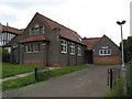
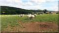
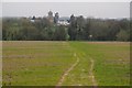
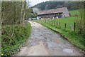
Photos of Suckley


Area Information
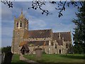
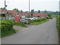
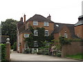
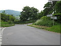
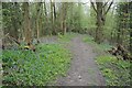
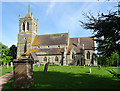
You are considering a move to Suckley, a civil parish located in England that spans 10.9 km². This rural community offers a quiet lifestyle defined by its small, managed size and established character. Living in Suckley means embracing a slower pace where daily routines centre on local needs rather than city centre commutes. The area attracts those seeking tranquility without sacrificing essential amenities found within a reasonable distance. Your chosen home will sit within a space dedicated to pastoral scenery and traditional village life. The layout of the parish supports independent living, making it suitable for retirees or remote workers who value space and peace. You will find the environment calm and predictable, lacking the congestion found in larger urban centres. The land is developed thoughtfully to maintain the integrity of the surrounding landscape. As you explore the possibility of buying property here, note that the settlement functions as a cohesive unit with a clear sense of place. The compact nature of the 10.9 km² footprint ensures that distances between homes and local services remain short. This geographical constraint fosters a tight-knit environment where neighbours are often familiar with one another.
- Area Type
- Parish
- Area Size
- 10.9 km²
- Population
- Not available
- Population Density
- Not available
Demographics
The community in Suckley reflects an older population with a median age of 70 years. Most residents fall into the 'Age: Total' category, indicating a settlement where older age groups form the demographic core. You will not find a swing between those aged under 25 and those over 65 as pronounced as in university towns. Instead, the social fabric revolves around the needs and habits of senior citizens. Home ownership stands at 78%, meaning the vast majority of houses are occupied by their owners rather than tenants. This high level of tenure suggests deep community roots and stability. Residents likely have spent decades building their homes and watching the parish grow around them. The household composition and accommodation type data show a settled pattern, with families or individuals choosing to stay long-term. You will notice that the area lacks significant transient populations, which contributes to a consistent social atmosphere. Crime statistics reinforce this stable environment with a safety score of 89/100, indicating below-average crime rates. This combination of high homeownership and low crime creates a secure backdrop for daily life.
Household Size
Accommodation Type
Tenure
Ethnic Group
Religion
Household Composition
Age
Household Deprivation
NS-SEC
Explore more demographic insights in this area
Go to Demographics tabPlanning
Planning Constraints
- Flood RiskPremium
- Ramsar Wetland SitesPremium
- Area of Outstanding Natural BeautyPremium
- Protected Nature ReservePremium
- Protected WoodlandPremium
- Crime RiskPremium