Area Overview for Streetly
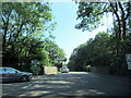
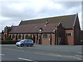
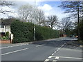
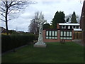
Photos of Streetly


Area Information
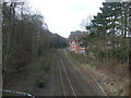
Living in Streetly offers a quiet, compact lifestyle in a built-up area spanning 5.2 km². With a population of 1,471 and a density of 285 people per square kilometre, it is a small, closely knit community. The area’s modest size means amenities and services are within easy reach, while its location in England positions it as a practical choice for those seeking a balance between suburban comfort and accessibility. Streetly’s character is shaped by its older demographic, with a median age of 70, suggesting a population that values stability and familiarity. Daily life here is likely defined by routine, with local shops, rail links, and schools forming the backbone of community interaction. The presence of five nearby rail stations, including Butlers Lane and Four Oaks, ensures connectivity to larger towns, while a mix of retail options, such as Co-op Streetly and Tesco, supports everyday needs. Streetly is not a place for those seeking a fast-paced urban environment but suits those prioritising a slower, more predictable rhythm of life.
- Area Type
- Built Up Area 250
- Area Size
- 5.2 km²
- Population
- 1471
- Population Density
- 285 people/km²
Streetly’s lifestyle is centred around its compact size and proximity to essential amenities. The area has five retail outlets, including Co-op Streetly, Tesco Streetly, and Waitrose Little, offering a range of shopping options for daily needs. These stores, combined with the nearby rail stations, create a convenient environment for residents who prefer to walk or cycle short distances. The absence of specific parks or leisure facilities in the data means outdoor recreation may require travel to adjacent areas, though the rail links could facilitate this. The presence of multiple schools and shops suggests a community that values accessibility over expansive green spaces. For those prioritising convenience over large-scale amenities, Streetly provides a functional, no-frills lifestyle with services and transport options within practical reach.
Amenities
Schools
Streetly has five primary schools within its vicinity, including St Anne’s Catholic Primary School, which holds an Ofsted rating of outstanding. Other schools, such as Manor Primary School and Lindens Primary School, are rated good, while Blackwood School and The Streetly School have no specified ratings. The concentration of primary schools suggests a family-friendly environment, with multiple options for parents to choose from. The presence of schools with high Ofsted ratings, such as St Anne’s, indicates at least some institutions delivering strong educational outcomes. However, the absence of secondary schools in the data means families with older children may need to look beyond Streetly for secondary education. The mix of school types, while limited to primary levels, provides a degree of choice for families prioritising early education quality.
| Rank | School | Type | Entry gender | Ages |
|---|
Explore more schools in this area
Go to Schools tabDemographics
Streetly’s population has a median age of 70, the highest in the dataset, indicating a community skewed towards older residents. This age profile suggests a demographic that may prioritise stability over expansion, with 88% of households owning their homes. The high home ownership rate reflects a long-term presence in the area, reducing turnover and fostering a sense of continuity. However, the data does not specify household composition or accommodation types, so details on family structures or property mix remain unclear. The absence of specific figures on diversity or deprivation means the community’s social fabric is not fully quantified, but the high home ownership and older age group imply a population that may be less transient. For prospective buyers, this could mean a neighbourhood with established networks but fewer opportunities for younger families or renters. The lack of detailed data on ethnicity or religion also limits understanding of the area’s cultural dynamics.
Household Size
Accommodation Type
Tenure
Ethnic Group
Religion
Household Composition
Age
Household Deprivation
NS-SEC
Explore more demographic insights in this area
Go to Demographics tabPlanning
Planning Constraints
- Crime RiskPremium