Area Overview for Stratford Orchard Hill Ward
Photos of Stratford Orchard Hill Ward

Area Information
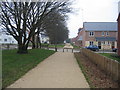
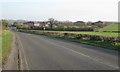
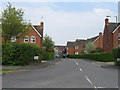
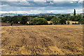
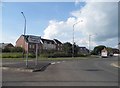
Living in Stratford Orchard Hill Ward offers a distinctive experience defined by its quiet character and established community feel. This district borough unitary ward spans a compact area of precisely 5.4 km², providing a manageable and intimate setting for residents. You will find that daily life here is shaped by a long-term population with an impressive median age of 70 years, indicating a mature demographic focused on stability and established neighbourhoods rather than rapid development. The high degree of permanence is reflected in the steady presence of families and individuals who have chosen to call this small ward their home for decades. There is a strong sense of continuity within the area, where decades of residency have fostered deep-rooted community ties and a predictable, serene environment. You can expect a pace of life that prioritises tranquillity and local knowledge over the transient nature often found in faster-growing urban zones. The limited geographical footprint means that many essentials are likely within walking distance, contributing to a self-contained lifestyle where you do not need to travel far for daily needs. Whether you are looking for homes in Stratford Orchard Hill Ward or simply exploring the character of this unique locale, the consistent demographic profile and compact size create a setting that values tradition, security, and a slower, more deliberate rhythm.
- Area Type
- District Borough Unitary Ward
- Area Size
- 5.4 km²
- Population
- Not available
- Population Density
- Not available
Demographics
The community within Stratford Orchard Hill Ward is largely composed of older generations, with a median age of 70 years. This age profile suggests a neighbours who have built long-term lives in the district, bringing a stability that defines the ward's character. The area is not centred around young families or single professionals moving in for short-term gains, but rather by established residents who have settled here for life. Despite the older age structure, the ward maintains a high level of permanence, with 70% of households classified as owner-occupied. This indicates that the local community is predominantly invested in their homes and neighbourhood, rather than relying on transient renting arrangements. You will find that the local population consists of individuals and families who have put their roots down deeply, resulting in a stable social environment. While specific details regarding ethnicity, religious composition, and detailed household breakdowns are not available in the current records, the prevailing picture is one of an established, settled community where long-term residency is the norm rather than the exception. The demographic reality means that local schools near Stratford Orchard Hill Ward would primarily serve children of working parents who have been residents, and local businesses operate with an eye towards the consistent needs of an older, stable clientele. The 70% ownership rate further reinforces the idea of a community built on commitment and stability, where residents are likely to engage with local initiatives and maintain connections with their neighbours for decades.
Household Size
Accommodation Type
Tenure
Ethnic Group
Religion
Household Composition
Age
Household Deprivation
NS-SEC
Explore more demographic insights in this area
Go to Demographics tabPlanning
Planning Constraints
- Flood RiskPremium
- Ramsar Wetland SitesPremium
- Area of Outstanding Natural BeautyPremium
- Protected Nature ReservePremium
- Protected WoodlandPremium
- Crime RiskPremium