Area Overview for Stourbridge
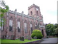
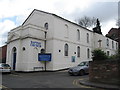
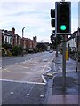
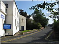
Photos of Stourbridge


Area Information
Stourbridge is a built-up area in England covering 14.6 km², home to 19,654 residents. Its population density of 1,348 people per square kilometre suggests a compact, established town with a mix of residential and commercial spaces. The area’s character is shaped by its proximity to nearby towns and its blend of traditional and modern infrastructure. With a median age of 70, the community reflects a demographic skewed towards older residents, which may influence local services and social dynamics. Daily life in Stourbridge is defined by accessibility to key amenities, including multiple railway stations and retail hubs, making it practical for commuters and families. The town’s compact size ensures that essential services are within walking or short driving distance, supporting a lifestyle that balances convenience with a sense of community. For those considering living here, Stourbridge offers a quieter, less densely populated alternative to larger cities, with a focus on local connectivity and established infrastructure. Its appeal lies in its practicality, safety, and the presence of well-rated schools, which cater to families seeking stability and quality education.
- Area Type
- Built Up Area 250
- Area Size
- 14.6 km²
- Population
- 19654
- Population Density
- 1348 people/km²
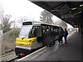
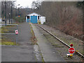
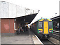
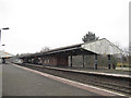
Stourbridge’s lifestyle is shaped by its accessible amenities, including five railway stations such as Stourbridge Town and Lye, which provide easy access to nearby towns and cities. Retail options like Tesco Stourbridge and Aldi New offer convenience for grocery shopping, while Iceland Stourbridge adds variety to local stores. Though no parks or leisure facilities are explicitly listed, the area’s compact size ensures that essential services are within walking distance. The presence of multiple retail outlets and transport links suggests a community focused on practicality and ease of access. For residents, this means a lifestyle that prioritises convenience, with minimal need to travel far for daily needs. The mix of retail and transport options supports a balanced approach to living, blending local connectivity with broader regional access.
Amenities
Schools
Stourbridge is served by five primary schools, including Beauty Bank Primary School, Greenfield Primary School (Ofsted rating: good), Wollescote Primary School (Ofsted rating: good), Rufford Primary School, and The Ridge Primary School (Ofsted rating: good). The presence of three schools with a ‘good’ Ofsted rating highlights a strong foundation for primary education in the area. These institutions cater to local families, offering a range of educational options. The concentration of primary schools suggests that the area is well-suited for households with young children, ensuring proximity to schooling. While no secondary schools are listed, the availability of well-rated primary schools supports families seeking reliable early education. The mix of schools reflects a commitment to educational quality, though further research would be needed to assess broader educational provision.
| Rank | School | Type | Entry gender | Ages |
|---|
Explore more schools in this area
Go to Schools tabDemographics
Stourbridge’s population has a median age of 70, indicating a community predominantly composed of older residents. This age profile may influence local services, with a focus on healthcare and retirement amenities. Home ownership stands at 70%, suggesting a stable housing market where most residents live in their own homes rather than renting. The data does not specify household composition or accommodation types, but the high home ownership rate implies a long-term resident base. The area’s demographic makeup is not detailed in terms of ethnicity or religion, but the population density of 1,348 per km² suggests a tightly knit community. While no explicit data on deprivation is provided, the combination of high home ownership and moderate population density may indicate a relatively stable quality of life, with fewer socioeconomic challenges compared to more densely populated urban areas.
Household Size
Accommodation Type
Tenure
Ethnic Group
Religion
Household Composition
Age
Household Deprivation
NS-SEC
Explore more demographic insights in this area
Go to Demographics tabPlanning
Planning Constraints
- Crime RiskPremium