Area Overview for Stock and Bradley
Photos of Stock and Bradley
Area Information
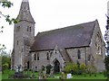
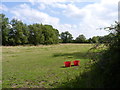
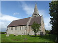
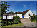
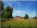
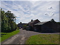
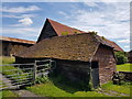
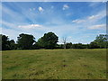
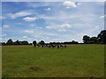
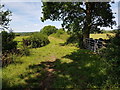
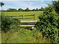
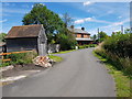
Stock and Bradley is a compact civil parish in Worcestershire, covering an area of 4.7 square kilometres. The settlement comprises the villages of Stock Green and Bradley Green, situated roughly six miles east of Droitwich and twelve miles north-east of Worcester. You find this parish within the West Midlands region, anchored by a specific postcode of B96 6TL. The community has deep historical roots, originating as a chapelry of Fladbury before becoming a separate civil parish in 1866. Its history dates back to pre-Roman times when the Cornovii tribe inhabited the land. Today, the landscape features the distinct parish church of St Mary's and All Saints, which was rebuilt in 1863 in an Early Decorated style. Living in Stock and Bradley means navigating the spaces of Stock Green and Bradley Green, where local institutions like the Old Schoolhouse and the former Bradley Trust hall still shape daily life. The location offers direct links to nearby towns, yet retains its identity as a settled parish. You will see the broach spire of the main church dominate the skyline, a testament to the community's architectural heritage. The area remains small enough to foster a close-knit environment while providing reasonable access to the wider Worcestershire network. This parish serves as a quiet residential base for those seeking a connection to history without the complexity of larger urban centres. The defined boundaries and civil status ensure a stable administrative framework for all residents.
- Area Type
- Parish
- Area Size
- 4.7 km²
- Population
- Not available
- Population Density
- Not available
Demographics
The community profile of Stock and Bradley reflects a distinctly settled population. The median age across the parish stands at exactly 70 years, indicating a resident base that is significantly older than the national average. While specific data on the most common age range beyond the total is not detailed in this overview, the high median age suggests a retirement-heavy demographic. Approximately 78% of households in Stock and Bradley own their homes outright. This high level of tenure confirms that the area is primarily owner-occupied rather than rental-dependent. You will find very few private rentals compared to the vast majority of owner-occupiers. Household composition within the parish tends towards stability, validating the low population turnover typical of such older settlements. The demographic skew towards an elderly population means that families with young children may find fewer peers, though the existing community structures support those who have stayed or retired there. The area does not present any data regarding predominant ethnic groups or specific religious breakdowns, but the overall statistical picture points to a traditional, long-standing community. Deprivation metrics are not explicitly provided, yet the high home ownership rate and older demographic often correlate with established, stable neighbourhoods rather than high-turnover developments. The social fabric here is defined by long-term residents who have built their lives in Stock Green and Bradley Green over decades.
Household Size
Accommodation Type
Tenure
Ethnic Group
Religion
Household Composition
Age
Household Deprivation
NS-SEC
Explore more demographic insights in this area
Go to Demographics tabPlanning
Planning Constraints
- Flood RiskPremium
- Ramsar Wetland SitesPremium
- Area of Outstanding Natural BeautyPremium
- Protected Nature ReservePremium
- Protected WoodlandPremium
- Crime RiskPremium