Area Overview for ST9 9LP
Photos of ST9 9LP
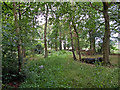
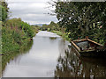
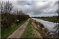
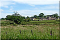
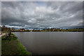
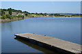
7 photos from this area
Area Information
Key information about the ST9 9LP including its size, population, and administrative classification.
- Area Type
- Postcode
- Area Size
- 29.8 hectares
- Population
- 1626
- Population Density
- 130 people/km²
House Prices in ST9 9LP
40
Properties
£345,819
Average Sold Price
£125,000
Lowest Price
£740,000
Highest Price
Showing 40 properties
| Address | Type | Beds | Baths | Last Sale Price | Last Sale Date | |
|---|---|---|---|---|---|---|
| Moorland View, Clewlows Bank, Stockton Brook, ST9 9LP | Bungalow | - | - | £330,000 | Feb 2025 | |
| Linley, Clewlows Bank, Bagnall, ST9 9LP | Bungalow | 2 | 1 | £345,000 | Apr 2024 | |
| Allancroft, Clewlows Bank, Bagnall, ST9 9LP | Detached | 4 | 3 | £695,000 | Feb 2023 | |
| Lime Tree House, Clewlows Bank, Bagnall, ST9 9LP | Detached | 4 | 3 | £740,000 | Jan 2023 | |
| Ye Old Police House, Clewlows Bank, Bagnall, ST9 9LP | Semi-detached | 2 | 1 | £438,000 | Jan 2023 | |
| Grayford, Clewlows Bank, Bagnall, ST9 9LP | Bungalow | - | - | £490,000 | Sep 2021 | |
| Oaklea, Clewlows Bank, Bagnall, ST9 9LP | Bungalow | - | - | £351,250 | Aug 2021 | |
| Merrendale, Clewlows Bank, Stockton Brook, ST9 9LP | Detached | 4 | 3 | £280,000 | Nov 2020 | |
| Quinton, Clewlows Bank, Bagnall, ST9 9LP | Detached | 5 | 3 | £385,000 | Nov 2018 | |
| Roche View, Clewlows Bank, Bagnall, ST9 9LP | house | - | - | £270,000 | Jun 2018 |
Page 1 of 4
Energy Efficiency in ST9 9LP
Amenities
Schools
| Rank | School | Type | Entry gender | Ages |
|---|
Explore more schools in this area
Go to Schools tabDemographics
Household Size
Two person
most common
Accommodation Type
Houses
most common
Tenure
90
majority
Ethnic Group
White
most common
Religion
N/A
most common
Household Composition
N/A
most common
Age
47
median
Adults (30-64 years)
most common
Household Deprivation
N/A
with no deprivation
NS-SEC
43
in Lower managerial occupations
Explore more demographic insights in this area
Go to Demographics tabPlanning
Planning Constraints
- Flood RiskPremium
- Ramsar Wetland SitesPremium
- Area of Outstanding Natural BeautyPremium
- Protected Nature ReservePremium
- Protected WoodlandPremium