Area Overview for ST9 0ET
Photos of ST9 0ET
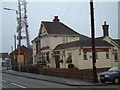
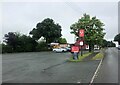
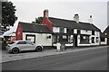
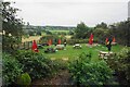
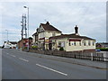
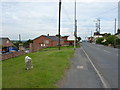
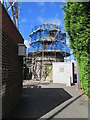
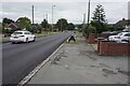

17 photos from this area
Area Information
Key information about the ST9 0ET including its size, population, and administrative classification.
- Area Type
- Postcode
- Area Size
- 1.3 hectares
- Population
- 1607
- Population Density
- 3194 people/km²
House Prices in ST9 0ET
18
Properties
£343,889
Average Sold Price
£170,000
Lowest Price
£780,000
Highest Price
Showing 18 properties
| Address | Type | Beds | Baths | Last Sale Price | Last Sale Date | |
|---|---|---|---|---|---|---|
| 3 Sandy Hill, Werrington, ST9 0ET | Bungalow | 3 | 1 | £360,000 | Jun 2022 | |
| 1 Sandy Hill, Werrington, ST9 0ET | Detached | 5 | 2 | £400,000 | May 2021 | |
| 33 Sandy Hill, Werrington, ST9 0ET | Bungalow | - | - | £245,000 | Jan 2021 | |
| Witts End, 29 Sandy Hill, Werrington, ST9 0ET | Detached | 5 | 2 | £415,000 | Sep 2018 | |
| Elizabeth House Residential Home, Sandy Hill, Werrington, ST9 0ET | hospital_care_home | - | - | £780,000 | Feb 2018 | |
| 11 Sandy Hill, Werrington, ST9 0ET | Detached | 4 | - | £290,000 | Nov 2013 | |
| 23 Sandy Hill, Werrington, ST9 0ET | Detached | - | - | £245,000 | Sep 2007 | |
| 35 Sandy Hill, Werrington, ST9 0ET | Detached | - | - | £190,000 | May 2006 | |
| 17 Sandy Hill, Werrington, ST9 0ET | Detached | - | - | £170,000 | Jan 2003 | |
| 9 Sandy Hill, Werrington, ST9 0ET | Detached | - | - | - | - |
Page 1 of 2
Energy Efficiency in ST9 0ET
Amenities
Schools
| Rank | School | Type | Entry gender | Ages |
|---|
Explore more schools in this area
Go to Schools tabDemographics
Household Size
Two person
most common
Accommodation Type
Houses
most common
Tenure
84
majority
Ethnic Group
White
most common
Religion
N/A
most common
Household Composition
N/A
most common
Age
47
median
Adults (30-64 years)
most common
Household Deprivation
N/A
with no deprivation
NS-SEC
30
in Lower managerial occupations
Explore more demographic insights in this area
Go to Demographics tabPlanning
Planning Constraints
- Flood RiskPremium
- Ramsar Wetland SitesPremium
- Area of Outstanding Natural BeautyPremium
- Protected Nature ReservePremium
- Protected WoodlandPremium