Area Overview for ST7 1LS
Photos of ST7 1LS

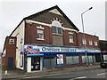
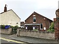
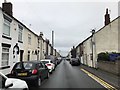
43 photos from this area
Area Information
Key information about the ST7 1LS including its size, population, and administrative classification.
- Area Type
- Postcode
- Area Size
- 4382 m²
- Population
- 1584
- Population Density
- 1821 people/km²
House Prices in ST7 1LS
13
Properties
£64,143
Average Sold Price
£34,000
Lowest Price
£140,000
Highest Price
Showing 13 properties
| Address | Type | Beds | Baths | Last Sale Price | Last Sale Date | |
|---|---|---|---|---|---|---|
| 179 Congleton Road, Butt Lane, Kidsgrove, ST7 1LS | Semi-detached | 6 | 5 | £140,000 | Mar 2023 | |
| 185 Congleton Road, Butt Lane, Kidsgrove, ST7 1LS | house | - | - | £51,000 | Oct 2009 | |
| 197 Congleton Road, Butt Lane, Kidsgrove, ST7 1LS | house | 2 | - | £90,000 | Jul 2007 | |
| 193 Congleton Road, Butt Lane, Kidsgrove, ST7 1LS | house | - | - | £52,000 | Jun 2004 | |
| 187 Congleton Road, Butt Lane, Kidsgrove, ST7 1LS | Terraced | - | - | £46,000 | Mar 2003 | |
| 201 Congleton Road, Butt Lane, Kidsgrove, ST7 1LS | Terraced | - | - | £36,000 | Jun 2002 | |
| 199 Congleton Road, Butt Lane, Kidsgrove, ST7 1LS | Terraced | - | - | £34,000 | Dec 2001 | |
| 181 Congleton Road, Butt Lane, Kidsgrove, ST7 1LS | Terraced | - | - | - | - | |
| 189 Congleton Road, Butt Lane, Kidsgrove, ST7 1LS | Detached | - | - | - | - | |
| 195 Congleton Road, Butt Lane, Kidsgrove, ST7 1LS | Terraced | - | - | - | - |
Page 1 of 2
Energy Efficiency in ST7 1LS
Amenities
Schools
| Rank | School | Type | Entry gender | Ages |
|---|
Explore more schools in this area
Go to Schools tabDemographics
Household Size
Two person
most common
Accommodation Type
Houses
most common
Tenure
73
majority
Ethnic Group
White
most common
Religion
N/A
most common
Household Composition
N/A
most common
Age
47
median
Adults (30-64 years)
most common
Household Deprivation
N/A
with no deprivation
NS-SEC
29
in Lower managerial occupations
Explore more demographic insights in this area
Go to Demographics tabPlanning
Planning Constraints
- Flood RiskPremium
- Ramsar Wetland SitesPremium
- Area of Outstanding Natural BeautyPremium
- Protected Nature ReservePremium
- Protected WoodlandPremium