Area Overview for ST6 8TY
Photos of ST6 8TY

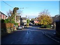
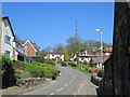
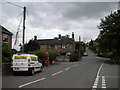
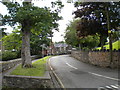
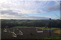
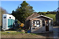
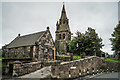
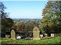
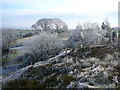
15 photos from this area
Area Information
Key information about the ST6 8TY including its size, population, and administrative classification.
- Area Type
- Postcode
- Area Size
- 26.5 hectares
- Population
- 1426
- Population Density
- 221 people/km²
House Prices in ST6 8TY
20
Properties
£328,000
Average Sold Price
£78,000
Lowest Price
£550,000
Highest Price
Showing 20 properties
| Address | Type | Beds | Baths | Last Sale Price | Last Sale Date | |
|---|---|---|---|---|---|---|
| Clewlow Bank House, Hill Top, Brown Edge, ST6 8TY | Detached | 3 | - | £550,000 | Jul 2025 | |
| Crumble Cottage, Hill Top, Brown Edge, ST6 8TY | Detached | 3 | 1 | £375,000 | Aug 2024 | |
| Roselyn, Hill Top, Brown Edge, ST6 8TY | Cottage | 3 | 1 | £395,000 | Aug 2024 | |
| Alpha Bungalow, Hill Top, Brown Edge, ST6 8TY | Bungalow | 2 | 1 | £295,000 | Feb 2020 | |
| Star Farm, Hill Top, Brown Edge, ST6 8TY | Bungalow | 3 | 1 | £409,000 | Oct 2018 | |
| Fields View, Hill Top, Brown Edge, ST6 8TY | Detached | 4 | 2 | £360,000 | Sep 2016 | |
| Marsh Cottage, Hill Top, Brown Edge, ST6 8TY | Detached | 4 | 3 | £162,000 | Aug 2009 | |
| Hunters Moon, Hill Top, Brown Edge, ST6 8TY | house | 2 | - | £78,000 | May 2002 | |
| East View, Hill Top, Brown Edge, ST6 8TY | Semi-detached | 3 | 1 | - | - | |
| Burnfields Farm, Hill Top, Brown Edge, ST6 8TY | house | 4 | 1 | - | - |
Page 1 of 2
Energy Efficiency in ST6 8TY
Amenities
Schools
| Rank | School | Type | Entry gender | Ages |
|---|
Explore more schools in this area
Go to Schools tabDemographics
Household Size
Two person
most common
Accommodation Type
Houses
most common
Tenure
92
majority
Ethnic Group
White
most common
Religion
N/A
most common
Household Composition
N/A
most common
Age
47
median
Adults (30-64 years)
most common
Household Deprivation
N/A
with no deprivation
NS-SEC
33
in Lower managerial occupations
Explore more demographic insights in this area
Go to Demographics tabPlanning
Planning Constraints
- Flood RiskPremium
- Ramsar Wetland SitesPremium
- Area of Outstanding Natural BeautyPremium
- Protected Nature ReservePremium
- Protected WoodlandPremium