Area Overview for ST6 8SW
Photos of ST6 8SW
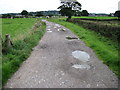
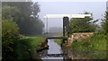
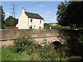
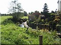
23 photos from this area
Area Information
Key information about the ST6 8SW including its size, population, and administrative classification.
- Area Type
- Postcode
- Area Size
- 47.1 hectares
- Population
- 1626
- Population Density
- 130 people/km²
House Prices in ST6 8SW
34
Properties
£266,875
Average Sold Price
£28,000
Lowest Price
£850,000
Highest Price
Showing 34 properties
| Address | Type | Beds | Baths | Last Sale Price | Last Sale Date | |
|---|---|---|---|---|---|---|
| 105 Ball Lane, Norton Green, Stoke On Trent, ST6 8SW | house | - | - | £250,000 | Aug 2024 | |
| 113 Ball Lane, Norton Green, Stoke On Trent, ST6 8SW | Semi-detached | 3 | 1 | £275,000 | Aug 2023 | |
| Rose Lea, Ball Lane, Brown Edge, ST6 8SW | Bungalow | 2 | 1 | £579,000 | Apr 2023 | |
| Fair View, Ball Lane, Brown Edge, ST6 8SW | house | - | - | £850,000 | Jun 2022 | |
| 109 Ball Lane, Norton Green, Stoke On Trent, ST6 8SW | Semi-detached | 3 | 1 | £190,000 | Dec 2019 | |
| 89 Ball Lane, Norton Green, Stoke On Trent, ST6 8SW | Semi-detached | - | - | £180,000 | Oct 2016 | |
| 99 Ball Lane, Norton Green, Stoke On Trent, ST6 8SW | Semi-detached | 3 | 1 | £155,000 | Jun 2016 | |
| 115 Ball Lane, Norton Green, Stoke On Trent, ST6 8SW | Bungalow | 2 | 1 | £250,000 | Aug 2013 | |
| 101 Ball Lane, Norton Green, Stoke On Trent, ST6 8SW | Detached | 3 | 1 | £265,000 | Aug 2013 | |
| Jasmine Cottage, Ball Lane, Brown Edge, ST6 8SW | Semi-detached | 3 | 2 | £230,000 | May 2013 |
Page 1 of 4
Energy Efficiency in ST6 8SW
Amenities
Schools
| Rank | School | Type | Entry gender | Ages |
|---|
Explore more schools in this area
Go to Schools tabDemographics
Household Size
Two person
most common
Accommodation Type
Houses
most common
Tenure
90
majority
Ethnic Group
White
most common
Religion
N/A
most common
Household Composition
N/A
most common
Age
47
median
Adults (30-64 years)
most common
Household Deprivation
N/A
with no deprivation
NS-SEC
43
in Lower managerial occupations
Explore more demographic insights in this area
Go to Demographics tabPlanning
Planning Constraints
- Flood RiskPremium
- Ramsar Wetland SitesPremium
- Area of Outstanding Natural BeautyPremium
- Protected Nature ReservePremium
- Protected WoodlandPremium