Area Overview for ST6 8SE
Photos of ST6 8SE
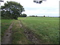
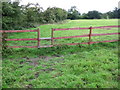
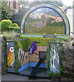
3 photos from this area
Area Information
Key information about the ST6 8SE including its size, population, and administrative classification.
- Area Type
- Postcode
- Area Size
- 1.2 hectares
- Population
- 1548
- Population Density
- 1389 people/km²
House Prices in ST6 8SE
20
Properties
£87,264
Average Sold Price
£32,500
Lowest Price
£260,000
Highest Price
Showing 20 properties
| Address | Type | Beds | Baths | Last Sale Price | Last Sale Date | |
|---|---|---|---|---|---|---|
| 15 Greenfield Avenue, Brown Edge, ST6 8SE | Semi-detached | 4 | 1 | £260,000 | Oct 2024 | |
| 19 Greenfield Avenue, Brown Edge, ST6 8SE | Semi-detached | 3 | 1 | £89,000 | Dec 2020 | |
| 17 Greenfield Avenue, Brown Edge, ST6 8SE | Semi-detached | 3 | 1 | £80,000 | Nov 2018 | |
| 3 Greenfield Avenue, Brown Edge, ST6 8SE | house | - | - | £85,000 | Jun 2013 | |
| 8 Greenfield Avenue, Brown Edge, ST6 8SE | house | - | - | £75,000 | Oct 2012 | |
| 11 Greenfield Avenue, Brown Edge, ST6 8SE | house | - | - | £66,500 | Apr 2009 | |
| 16 Greenfield Avenue, Brown Edge, ST6 8SE | Semi-detached | - | - | £94,950 | Jan 2006 | |
| 4 Greenfield Avenue, Brown Edge, ST6 8SE | Semi-detached | - | - | £87,000 | Mar 2005 | |
| 2 Greenfield Avenue, Brown Edge, ST6 8SE | Semi-detached | - | - | £45,000 | Jun 2003 | |
| 10 Greenfield Avenue, Brown Edge, ST6 8SE | house | - | - | £32,500 | Sep 2002 |
Page 1 of 2
Energy Efficiency in ST6 8SE
Amenities
Schools
| Rank | School | Type | Entry gender | Ages |
|---|
Explore more schools in this area
Go to Schools tabDemographics
Household Size
Two person
most common
Accommodation Type
Houses
most common
Tenure
78
majority
Ethnic Group
White
most common
Religion
N/A
most common
Household Composition
N/A
most common
Age
47
median
Adults (30-64 years)
most common
Household Deprivation
N/A
with no deprivation
NS-SEC
30
in Lower managerial occupations
Explore more demographic insights in this area
Go to Demographics tabPlanning
Planning Constraints
- Flood RiskPremium
- Ramsar Wetland SitesPremium
- Area of Outstanding Natural BeautyPremium
- Protected Nature ReservePremium
- Protected WoodlandPremium