Area Overview for ST6 8RA
Photos of ST6 8RA
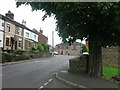
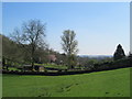
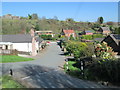
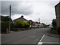
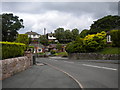
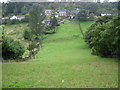
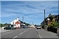

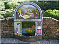
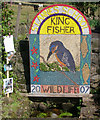

12 photos from this area
Area Information
Key information about the ST6 8RA including its size, population, and administrative classification.
- Area Type
- Postcode
- Area Size
- 3.5 hectares
- Population
- 1426
- Population Density
- 221 people/km²
House Prices in ST6 8RA
50
Properties
£173,976
Average Sold Price
£25,000
Lowest Price
£450,000
Highest Price
Showing 50 properties
| Address | Type | Beds | Baths | Last Sale Price | Last Sale Date | |
|---|---|---|---|---|---|---|
| Penmyath, 13 Church Road, Brown Edge, ST6 8RA | Bungalow | 2 | 1 | £238,000 | May 2025 | |
| 4 Church Road, Brown Edge, ST6 8RA | Bungalow | 3 | 1 | £265,000 | Feb 2024 | |
| Lucerne, 18 Church Road, Brown Edge, ST6 8RA | Bungalow | 2 | 1 | £200,000 | Jan 2024 | |
| 33 Church Road, Brown Edge, ST6 8RA | Retail | 3 | 1 | £391,000 | Jul 2022 | |
| 19 Church Road, Brown Edge, ST6 8RA | house | - | - | £450,000 | Dec 2020 | |
| Edgeside, Church Road, Brown Edge, ST6 8RA | Bungalow | - | - | £245,000 | Jun 2020 | |
| Tudor Cottage, 58 Church Road, Brown Edge, ST6 8RA | Semi-detached | 2 | 2 | £162,000 | Jan 2018 | |
| 60 Church Road, Brown Edge, ST6 8RA | Detached | 4 | 2 | £360,000 | Mar 2017 | |
| Tara, 5 Church Road, Brown Edge, ST6 8RA | Bungalow | 2 | 1 | £130,000 | Sep 2015 | |
| Highlyn, 32 Church Road, Brown Edge, ST6 8RA | Semi-detached | 3 | 1 | £140,000 | Sep 2014 |
Page 1 of 5
Energy Efficiency in ST6 8RA
Amenities
Schools
| Rank | School | Type | Entry gender | Ages |
|---|
Explore more schools in this area
Go to Schools tabDemographics
Household Size
Two person
most common
Accommodation Type
Houses
most common
Tenure
92
majority
Ethnic Group
White
most common
Religion
N/A
most common
Household Composition
N/A
most common
Age
47
median
Adults (30-64 years)
most common
Household Deprivation
N/A
with no deprivation
NS-SEC
33
in Lower managerial occupations
Explore more demographic insights in this area
Go to Demographics tabPlanning
Planning Constraints
- Flood RiskPremium
- Ramsar Wetland SitesPremium
- Area of Outstanding Natural BeautyPremium
- Protected Nature ReservePremium
- Protected WoodlandPremium