Area Overview for ST6 7PQ
Photos of ST6 7PQ
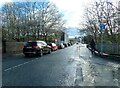
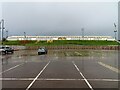

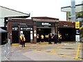
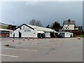
40 photos from this area
Area Information
Key information about the ST6 7PQ including its size, population, and administrative classification.
- Area Type
- Postcode
- Area Size
- 1.3 hectares
- Population
- 1328
- Population Density
- 4523 people/km²
House Prices in ST6 7PQ
36
Properties
£134,497
Average Sold Price
£48,000
Lowest Price
£180,000
Highest Price
Showing 36 properties
| Address | Type | Beds | Baths | Last Sale Price | Last Sale Date | |
|---|---|---|---|---|---|---|
| 32 Merrion Drive, Burslem, Stoke On Trent, ST6 7PQ | Bungalow | 2 | 1 | £179,995 | May 2025 | |
| 44 Merrion Drive, Burslem, Stoke On Trent, ST6 7PQ | Bungalow | 2 | 1 | £180,000 | Oct 2024 | |
| 56 Merrion Drive, Burslem, Stoke On Trent, ST6 7PQ | Bungalow | 2 | - | £150,000 | Jul 2023 | |
| 46 Merrion Drive, Burslem, Stoke On Trent, ST6 7PQ | Bungalow | 3 | 1 | £180,000 | May 2023 | |
| 26 Merrion Drive, Burslem, Stoke On Trent, ST6 7PQ | Bungalow | - | - | £160,000 | Jun 2021 | |
| 22 Merrion Drive, Burslem, Stoke On Trent, ST6 7PQ | Bungalow | - | - | £155,000 | Jun 2021 | |
| 72 Merrion Drive, Burslem, Stoke On Trent, ST6 7PQ | Detached | 2 | 1 | £112,500 | Jul 2020 | |
| 62 Merrion Drive, Burslem, Stoke On Trent, ST6 7PQ | Bungalow | 3 | 1 | £172,500 | Jan 2020 | |
| 2 Merrion Drive, Burslem, Stoke On Trent, ST6 7PQ | Bungalow | 3 | 1 | £155,000 | Mar 2018 | |
| 24 Merrion Drive, Burslem, Stoke On Trent, ST6 7PQ | Detached | - | - | £90,000 | Dec 2007 |
Page 1 of 4
Energy Efficiency in ST6 7PQ
Amenities
Schools
| Rank | School | Type | Entry gender | Ages |
|---|
Explore more schools in this area
Go to Schools tabDemographics
Household Size
One person
most common
Accommodation Type
Houses
most common
Tenure
59
majority
Ethnic Group
White
most common
Religion
N/A
most common
Household Composition
N/A
most common
Age
47
median
Elderly (65+ years)
most common
Household Deprivation
N/A
with no deprivation
NS-SEC
17
in Lower managerial occupations
Explore more demographic insights in this area
Go to Demographics tabPlanning
Planning Constraints
- Flood RiskPremium
- Ramsar Wetland SitesPremium
- Area of Outstanding Natural BeautyPremium
- Protected Nature ReservePremium
- Protected WoodlandPremium