Area Overview for ST6 6ND
Photos of ST6 6ND
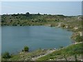
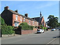
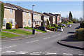
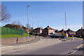

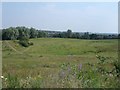
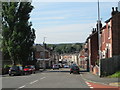
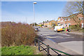
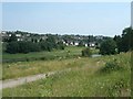
10 photos from this area
Area Information
Key information about the ST6 6ND including its size, population, and administrative classification.
- Area Type
- Postcode
- Area Size
- 5754 m²
- Population
- 1567
- Population Density
- 4680 people/km²
House Prices in ST6 6ND
13
Properties
£117,595
Average Sold Price
£34,000
Lowest Price
£180,000
Highest Price
Showing 13 properties
| Address | Type | Beds | Baths | Last Sale Price | Last Sale Date | |
|---|---|---|---|---|---|---|
| 84 Little Chell Lane, Little Chell, Stoke On Trent, ST6 6ND | Semi-detached | 3 | 1 | £170,000 | Apr 2022 | |
| 78 Little Chell Lane, Little Chell, Stoke On Trent, ST6 6ND | Semi-detached | 2 | 1 | £174,000 | Apr 2021 | |
| 74 Little Chell Lane, Little Chell, Stoke On Trent, ST6 6ND | Bungalow | 2 | 1 | £180,000 | Sep 2019 | |
| 76 Little Chell Lane, Little Chell, Stoke On Trent, ST6 6ND | Bungalow | 2 | 1 | £143,000 | Aug 2017 | |
| 96 Little Chell Lane, Little Chell, Stoke On Trent, ST6 6ND | house | 3 | 1 | £112,000 | Mar 2017 | |
| 86 Little Chell Lane, Little Chell, Stoke On Trent, ST6 6ND | Semi-detached | - | - | £129,950 | Feb 2007 | |
| 98 Little Chell Lane, Little Chell, Stoke On Trent, ST6 6ND | house | - | - | £110,000 | Jun 2006 | |
| 82 Little Chell Lane, Little Chell, Stoke On Trent, ST6 6ND | Semi-detached | - | - | £60,000 | Jan 2003 | |
| 92 Little Chell Lane, Little Chell, Stoke On Trent, ST6 6ND | Semi-detached | - | - | £63,000 | Sep 2002 | |
| 94 Little Chell Lane, Little Chell, Stoke On Trent, ST6 6ND | Semi-detached | - | - | £34,000 | Jul 2000 |
Page 1 of 2
Energy Efficiency in ST6 6ND
Amenities
Schools
| Rank | School | Type | Entry gender | Ages |
|---|
Explore more schools in this area
Go to Schools tabDemographics
Household Size
Two person
most common
Accommodation Type
Houses
most common
Tenure
62
majority
Ethnic Group
White
most common
Religion
N/A
most common
Household Composition
N/A
most common
Age
47
median
Adults (30-64 years)
most common
Household Deprivation
N/A
with no deprivation
NS-SEC
17
in Lower managerial occupations
Explore more demographic insights in this area
Go to Demographics tabPlanning
Planning Constraints
- Flood RiskPremium
- Ramsar Wetland SitesPremium
- Area of Outstanding Natural BeautyPremium
- Protected Nature ReservePremium
- Protected WoodlandPremium