Area Overview for ST6 6HJ
Photos of ST6 6HJ

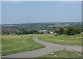
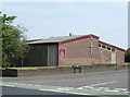
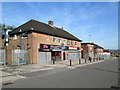
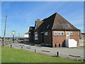
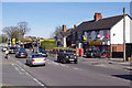
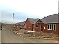
9 photos from this area
Area Information
Key information about the ST6 6HJ including its size, population, and administrative classification.
- Area Type
- Postcode
- Area Size
- 1.9 hectares
- Population
- 1620
- Population Density
- 7121 people/km²
House Prices in ST6 6HJ
31
Properties
£80,917
Average Sold Price
£37,000
Lowest Price
£112,000
Highest Price
Showing 31 properties
| Address | Type | Beds | Baths | Last Sale Price | Last Sale Date | |
|---|---|---|---|---|---|---|
| 533 Chell Heath Road, Chell Heath, Stoke On Trent, ST6 6HJ | Semi-detached | 3 | 1 | £112,000 | Dec 2019 | |
| 513 Chell Heath Road, Chell Heath, Stoke On Trent, ST6 6HJ | Semi-detached | 3 | 1 | £108,000 | Apr 2019 | |
| 535 Chell Heath Road, Chell Heath, Stoke On Trent, ST6 6HJ | Semi-detached | 3 | - | £110,500 | Nov 2017 | |
| 525 Chell Heath Road, Chell Heath, Stoke On Trent, ST6 6HJ | Semi-detached | 3 | 1 | £81,000 | Apr 2017 | |
| 529 Chell Heath Road, Chell Heath, Stoke On Trent, ST6 6HJ | Semi-detached | - | - | £37,000 | Aug 2000 | |
| 511 Chell Heath Road, Chell Heath, Stoke On Trent, ST6 6HJ | Semi-detached | - | - | £37,000 | Sep 1999 | |
| 453 Chell Heath Road, Chell Heath, Stoke On Trent, ST6 6HJ | Flat | - | - | - | - | |
| 517 Chell Heath Road, Chell Heath, Stoke On Trent, ST6 6HJ | house | 3 | - | - | - | |
| 487 Chell Heath Road, Chell Heath, Stoke On Trent, ST6 6HJ | house | - | - | - | - | |
| 527 Chell Heath Road, Chell Heath, Stoke On Trent, ST6 6HJ | house | - | - | - | - |
Page 1 of 4
Energy Efficiency in ST6 6HJ
Amenities
Schools
| Rank | School | Type | Entry gender | Ages |
|---|
Explore more schools in this area
Go to Schools tabDemographics
Household Size
Family (3-5 people)
most common
Accommodation Type
Houses
most common
Tenure
29
majority
Ethnic Group
White
most common
Religion
N/A
most common
Household Composition
N/A
most common
Age
47
median
Adults (30-64 years)
most common
Household Deprivation
N/A
with no deprivation
NS-SEC
12
in Lower managerial occupations
Explore more demographic insights in this area
Go to Demographics tabPlanning
Planning Constraints
- Flood RiskPremium
- Ramsar Wetland SitesPremium
- Area of Outstanding Natural BeautyPremium
- Protected Nature ReservePremium
- Protected WoodlandPremium