Area Overview for ST6 6HE
Photos of ST6 6HE

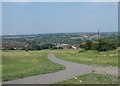
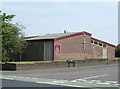
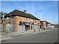
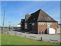
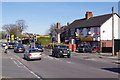
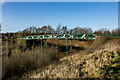
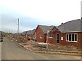
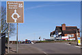
9 photos from this area
Area Information
Key information about the ST6 6HE including its size, population, and administrative classification.
- Area Type
- Postcode
- Area Size
- 9225 m²
- Population
- 1337
- Population Density
- 3076 people/km²
House Prices in ST6 6HE
20
Properties
£117,636
Average Sold Price
£42,000
Lowest Price
£205,000
Highest Price
Showing 20 properties
| Address | Type | Beds | Baths | Last Sale Price | Last Sale Date | |
|---|---|---|---|---|---|---|
| 926 High Lane, Burslem, Stoke On Trent, ST6 6HE | Semi-detached | 3 | 1 | £205,000 | Feb 2025 | |
| 900 High Lane, Burslem, Stoke On Trent, ST6 6HE | house | - | - | £155,000 | Jun 2022 | |
| 898 High Lane, Burslem, Stoke On Trent, ST6 6HE | Semi-detached | 3 | 1 | £145,000 | May 2020 | |
| 902 High Lane, Burslem, Stoke On Trent, ST6 6HE | house | - | - | £110,000 | Dec 2018 | |
| 904 High Lane, Burslem, Stoke On Trent, ST6 6HE | Semi-detached | 3 | 1 | £120,000 | Oct 2015 | |
| 930 High Lane, Burslem, Stoke On Trent, ST6 6HE | house | - | - | £78,000 | Nov 2012 | |
| 912 High Lane, Burslem, Stoke On Trent, ST6 6HE | house | 3 | - | £87,000 | Jan 2012 | |
| 928 High Lane, Burslem, Stoke On Trent, ST6 6HE | Semi-detached | - | - | £82,000 | Jul 2009 | |
| 934 High Lane, Burslem, Stoke On Trent, ST6 6HE | Semi-detached | 3 | 1 | £130,000 | Apr 2007 | |
| 892 High Lane, Burslem, Stoke On Trent, ST6 6HE | Semi-detached | 3 | 1 | £140,000 | Feb 2005 |
Page 1 of 2
Energy Efficiency in ST6 6HE
Amenities
Schools
| Rank | School | Type | Entry gender | Ages |
|---|
Explore more schools in this area
Go to Schools tabDemographics
Household Size
Family (3-5 people)
most common
Accommodation Type
Houses
most common
Tenure
58
majority
Ethnic Group
White
most common
Religion
N/A
most common
Household Composition
N/A
most common
Age
47
median
Adults (30-64 years)
most common
Household Deprivation
N/A
with no deprivation
NS-SEC
19
in Lower managerial occupations
Explore more demographic insights in this area
Go to Demographics tabPlanning
Planning Constraints
- Flood RiskPremium
- Ramsar Wetland SitesPremium
- Area of Outstanding Natural BeautyPremium
- Protected Nature ReservePremium
- Protected WoodlandPremium