Area Overview for ST6 6EB
Photos of ST6 6EB


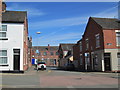
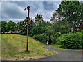

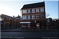
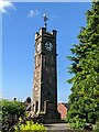
33 photos from this area
Area Information
Key information about the ST6 6EB including its size, population, and administrative classification.
- Area Type
- Postcode
- Area Size
- 2.8 hectares
- Population
- 1546
- Population Density
- 3724 people/km²
House Prices in ST6 6EB
56
Properties
£76,837
Average Sold Price
£23,250
Lowest Price
£120,000
Highest Price
Showing 56 properties
| Address | Type | Beds | Baths | Last Sale Price | Last Sale Date | |
|---|---|---|---|---|---|---|
| 70 Sunnyside Avenue, Tunstall, Stoke On Trent, ST6 6EB | house | - | - | £110,000 | Nov 2023 | |
| 56 Sunnyside Avenue, Tunstall, Stoke On Trent, ST6 6EB | Semi-detached | 2 | 1 | £95,000 | Jul 2021 | |
| 60 Sunnyside Avenue, Tunstall, Stoke On Trent, ST6 6EB | Semi-detached | 2 | 1 | £95,000 | Nov 2020 | |
| 36 Sunnyside Avenue, Tunstall, Stoke On Trent, ST6 6EB | Semi-detached | 3 | 1 | £120,000 | Mar 2020 | |
| 66 Sunnyside Avenue, Tunstall, Stoke On Trent, ST6 6EB | house | - | - | £68,000 | Mar 2017 | |
| 78 Sunnyside Avenue, Tunstall, Stoke On Trent, ST6 6EB | Semi-detached | 3 | - | £77,000 | Oct 2016 | |
| 20 Sunnyside Avenue, Tunstall, Stoke On Trent, ST6 6EB | Semi-detached | 3 | 1 | £108,000 | Oct 2016 | |
| 28 Sunnyside Avenue, Tunstall, Stoke On Trent, ST6 6EB | Semi-detached | 2 | - | £68,950 | Jan 2013 | |
| 84 Sunnyside Avenue, Tunstall, Stoke On Trent, ST6 6EB | house | 3 | - | £89,950 | Jan 2011 | |
| 72 Sunnyside Avenue, Tunstall, Stoke On Trent, ST6 6EB | house | - | - | £76,995 | Apr 2009 |
Page 1 of 6
Energy Efficiency in ST6 6EB
Amenities
Schools
| Rank | School | Type | Entry gender | Ages |
|---|
Explore more schools in this area
Go to Schools tabDemographics
Household Size
Family (3-5 people)
most common
Accommodation Type
Houses
most common
Tenure
46
majority
Ethnic Group
White
most common
Religion
N/A
most common
Household Composition
N/A
most common
Age
47
median
Adults (30-64 years)
most common
Household Deprivation
N/A
with no deprivation
NS-SEC
15
in Lower managerial occupations
Explore more demographic insights in this area
Go to Demographics tabPlanning
Planning Constraints
- Flood RiskPremium
- Ramsar Wetland SitesPremium
- Area of Outstanding Natural BeautyPremium
- Protected Nature ReservePremium
- Protected WoodlandPremium