Area Overview for ST6 5TA
Photos of ST6 5TA
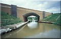
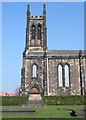
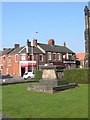
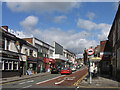
36 photos from this area
Area Information
Key information about the ST6 5TA including its size, population, and administrative classification.
- Area Type
- Postcode
- Area Size
- 8359 m²
- Population
- 1799
- Population Density
- 2696 people/km²
House Prices in ST6 5TA
20
Properties
£48,000
Average Sold Price
£40,000
Lowest Price
£56,000
Highest Price
Showing 20 properties
| Address | Type | Beds | Baths | Last Sale Price | Last Sale Date | |
|---|---|---|---|---|---|---|
| Flat, 69A High Street, Tunstall, Stoke On Trent, ST6 5TA | Maisonette | - | - | £56,000 | Jul 2008 | |
| 65 High Street, Tunstall, Stoke On Trent, ST6 5TA | Flat | - | - | £40,000 | Jun 2003 | |
| 75 High Street, Tunstall, Stoke On Trent, ST6 5TA | Retail | 2 | 1 | - | - | |
| 109A High Street, Tunstall, Stoke On Trent, ST6 5TA | Flat | - | - | - | - | |
| 99A High Street, Tunstall, Stoke On Trent, ST6 5TA | Flat | 3 | 1 | - | - | |
| The Tavern, 77-79 High Street, Tunstall, Stoke On Trent, ST6 5TA | Leisure | - | - | - | - | |
| 97A High Street, Tunstall, Stoke On Trent, ST6 5TA | Flat | - | - | - | - | |
| 57A High Street, Tunstall, Stoke On Trent, ST6 5TA | Flat | - | - | - | - | |
| The Globe Inn, 53 High Street, Tunstall, Stoke On Trent, ST6 5TA | Flat | - | - | - | - | |
| Living Accommodation, 77-79 High Street, Tunstall, Stoke On Trent, ST6 5TA | Flat | - | - | - | - |
Page 1 of 2
Energy Efficiency in ST6 5TA
Amenities
Schools
| Rank | School | Type | Entry gender | Ages |
|---|
Explore more schools in this area
Go to Schools tabDemographics
Household Size
One person
most common
Accommodation Type
Houses
most common
Tenure
36
majority
Ethnic Group
White
most common
Religion
N/A
most common
Household Composition
N/A
most common
Age
47
median
Adults (30-64 years)
most common
Household Deprivation
N/A
with no deprivation
NS-SEC
13
in Lower managerial occupations
Explore more demographic insights in this area
Go to Demographics tabPlanning
Planning Constraints
- Flood RiskPremium
- Ramsar Wetland SitesPremium
- Area of Outstanding Natural BeautyPremium
- Protected Nature ReservePremium
- Protected WoodlandPremium