Area Overview for ST6 5LN
Photos of ST6 5LN

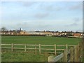
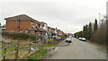

12 photos from this area
Area Information
Key information about the ST6 5LN including its size, population, and administrative classification.
- Area Type
- Postcode
- Area Size
- 3.2 hectares
- Population
- 2807
- Population Density
- 3355 people/km²
House Prices in ST6 5LN
45
Properties
£92,485
Average Sold Price
£12,000
Lowest Price
£160,000
Highest Price
Showing 45 properties
| Address | Type | Beds | Baths | Last Sale Price | Last Sale Date | |
|---|---|---|---|---|---|---|
| 89 Sandy Road, Sandyford, Stoke On Trent, ST6 5LN | Terraced | 3 | 1 | £142,000 | Nov 2024 | |
| 91 Sandy Road, Sandyford, Stoke On Trent, ST6 5LN | house | 3 | 1 | £81,000 | Mar 2024 | |
| 63 Sandy Road, Sandyford, Stoke On Trent, ST6 5LN | Terraced | 3 | 1 | £138,500 | Jan 2024 | |
| 17 Sandy Road, Sandyford, Stoke On Trent, ST6 5LN | Semi-detached | 3 | 1 | £103,000 | Aug 2023 | |
| 3 Sandy Road, Sandyford, Stoke On Trent, ST6 5LN | Semi-detached | 2 | 1 | £143,500 | Aug 2022 | |
| 65 Sandy Road, Sandyford, Stoke On Trent, ST6 5LN | Retail | 3 | 1 | £120,000 | Mar 2022 | |
| 93 Sandy Road, Sandyford, Stoke On Trent, ST6 5LN | house | - | - | £95,550 | Oct 2021 | |
| 15 Sandy Road, Sandyford, Stoke On Trent, ST6 5LN | house | 2 | 1 | £98,000 | May 2020 | |
| 73 Sandy Road, Sandyford, Stoke On Trent, ST6 5LN | Semi-detached | 4 | 1 | £123,000 | Mar 2019 | |
| 1 Sandy Road, Sandyford, Stoke On Trent, ST6 5LN | Semi-detached | 3 | 1 | £119,000 | Feb 2019 |
Page 1 of 5
Energy Efficiency in ST6 5LN
Amenities
Schools
| Rank | School | Type | Entry gender | Ages |
|---|
Explore more schools in this area
Go to Schools tabDemographics
Household Size
Family (3-5 people)
most common
Accommodation Type
Houses
most common
Tenure
82
majority
Ethnic Group
White
most common
Religion
N/A
most common
Household Composition
N/A
most common
Age
47
median
Adults (30-64 years)
most common
Household Deprivation
N/A
with no deprivation
NS-SEC
33
in Lower managerial occupations
Explore more demographic insights in this area
Go to Demographics tabPlanning
Planning Constraints
- Flood RiskPremium
- Ramsar Wetland SitesPremium
- Area of Outstanding Natural BeautyPremium
- Protected Nature ReservePremium
- Protected WoodlandPremium