Area Overview for ST6 2NZ
Photos of ST6 2NZ
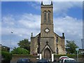
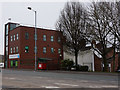
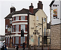
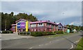
72 photos from this area
Area Information
Key information about the ST6 2NZ including its size, population, and administrative classification.
- Area Type
- Postcode
- Area Size
- 2.0 hectares
- Population
- 2016
- Population Density
- 2494 people/km²
House Prices in ST6 2NZ
21
Properties
£94,963
Average Sold Price
£40,000
Lowest Price
£131,000
Highest Price
Showing 21 properties
| Address | Type | Beds | Baths | Last Sale Price | Last Sale Date | |
|---|---|---|---|---|---|---|
| 86 Sneyd Street, Stoke On Trent, ST6 2NZ | Semi-detached | 2 | 1 | £131,000 | Sep 2022 | |
| 76 Sneyd Street, Stoke On Trent, ST6 2NZ | house | 2 | 1 | £126,000 | May 2021 | |
| 80 Sneyd Street, Stoke On Trent, ST6 2NZ | house | - | - | £87,000 | Jan 2020 | |
| 88 Sneyd Street, Stoke On Trent, ST6 2NZ | Semi-detached | 3 | 1 | £126,000 | Feb 2019 | |
| 90 Sneyd Street, Stoke On Trent, ST6 2NZ | house | - | - | £105,000 | Oct 2016 | |
| 96 Sneyd Street, Stoke On Trent, ST6 2NZ | Terraced | - | - | £40,000 | May 2013 | |
| 84 Sneyd Street, Stoke On Trent, ST6 2NZ | Semi-detached | 2 | 1 | £84,750 | May 2011 | |
| 98 Sneyd Street, Stoke On Trent, ST6 2NZ | Terraced | - | - | £59,950 | Dec 2005 | |
| Flat 1, 4-6 Sneyd Street, Stoke On Trent, ST6 2NZ | Retail | - | - | - | - | |
| 10 Sneyd Street, Stoke On Trent, ST6 2NZ | undefined | - | - | - | - |
Page 1 of 3
Energy Efficiency in ST6 2NZ
Amenities
Schools
| Rank | School | Type | Entry gender | Ages |
|---|
Explore more schools in this area
Go to Schools tabDemographics
Household Size
One person
most common
Accommodation Type
Houses
most common
Tenure
48
majority
Ethnic Group
White
most common
Religion
N/A
most common
Household Composition
N/A
most common
Age
47
median
Adults (30-64 years)
most common
Household Deprivation
N/A
with no deprivation
NS-SEC
18
in Lower managerial occupations
Explore more demographic insights in this area
Go to Demographics tabPlanning
Planning Constraints
- Flood RiskPremium
- Ramsar Wetland SitesPremium
- Area of Outstanding Natural BeautyPremium
- Protected Nature ReservePremium
- Protected WoodlandPremium