Area Overview for ST5 9ES
Photos of ST5 9ES

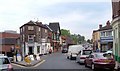
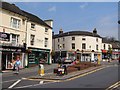


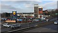
100 photos from this area
Area Information
Key information about the ST5 9ES including its size, population, and administrative classification.
- Area Type
- Postcode
- Area Size
- 1.3 hectares
- Population
- 1851
- Population Density
- 3971 people/km²
House Prices in ST5 9ES
43
Properties
£94,969
Average Sold Price
£42,000
Lowest Price
£130,000
Highest Price
Showing 43 properties
| Address | Type | Beds | Baths | Last Sale Price | Last Sale Date | |
|---|---|---|---|---|---|---|
| 52 Roberts Avenue, Newcastle Under Lyme, ST5 9ES | house | - | - | £91,500 | Jun 2025 | |
| 54 Roberts Avenue, Newcastle Under Lyme, ST5 9ES | house | - | - | £94,000 | Mar 2025 | |
| 61 Roberts Avenue, Newcastle Under Lyme, ST5 9ES | house | 2 | 1 | £90,000 | Jan 2025 | |
| 58 Roberts Avenue, Newcastle Under Lyme, ST5 9ES | house | - | - | £92,500 | Dec 2024 | |
| 60 Roberts Avenue, Newcastle Under Lyme, ST5 9ES | Terraced | 2 | 1 | £97,000 | May 2024 | |
| 56 Roberts Avenue, Newcastle Under Lyme, ST5 9ES | Terraced | 2 | 1 | £130,000 | Feb 2023 | |
| 28 Roberts Avenue, Newcastle Under Lyme, ST5 9ES | Terraced | 3 | 1 | £122,000 | Sep 2021 | |
| 50 Roberts Avenue, Newcastle Under Lyme, ST5 9ES | house | 2 | - | £78,000 | Apr 2021 | |
| 24 Roberts Avenue, Newcastle Under Lyme, ST5 9ES | Semi-detached | 4 | 2 | £106,000 | Oct 2019 | |
| 29 Roberts Avenue, Newcastle Under Lyme, ST5 9ES | house | - | - | £85,000 | May 2018 |
Page 1 of 5
Energy Efficiency in ST5 9ES
Amenities
Schools
| Rank | School | Type | Entry gender | Ages |
|---|
Explore more schools in this area
Go to Schools tabDemographics
Household Size
One person
most common
Accommodation Type
Houses
most common
Tenure
37
majority
Ethnic Group
White
most common
Religion
N/A
most common
Household Composition
N/A
most common
Age
47
median
Adults (30-64 years)
most common
Household Deprivation
N/A
with no deprivation
NS-SEC
17
in Lower managerial occupations
Explore more demographic insights in this area
Go to Demographics tabPlanning
Planning Constraints
- Flood RiskPremium
- Ramsar Wetland SitesPremium
- Area of Outstanding Natural BeautyPremium
- Protected Nature ReservePremium
- Protected WoodlandPremium