Area Overview for ST5 8EG
Photos of ST5 8EG
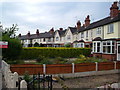


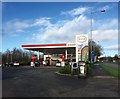
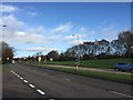


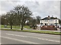
32 photos from this area
Area Information
Key information about the ST5 8EG including its size, population, and administrative classification.
- Area Type
- Postcode
- Area Size
- 5816 m²
- Population
- 1346
- Population Density
- 7288 people/km²
House Prices in ST5 8EG
29
Properties
£94,766
Average Sold Price
£30,000
Lowest Price
£195,000
Highest Price
Showing 29 properties
| Address | Type | Beds | Baths | Last Sale Price | Last Sale Date | |
|---|---|---|---|---|---|---|
| 49 Dimsdale View East, Newcastle Under Lyme, ST5 8EG | Terraced | 2 | 1 | £133,500 | Dec 2024 | |
| 3 Dimsdale View East, Newcastle Under Lyme, ST5 8EG | Terraced | 3 | 1 | £104,000 | Jul 2024 | |
| 57 Dimsdale View East, Newcastle Under Lyme, ST5 8EG | Semi-detached | 3 | 1 | £195,000 | Feb 2024 | |
| 11 Dimsdale View East, Newcastle Under Lyme, ST5 8EG | Semi-detached | 2 | 1 | £120,000 | Feb 2023 | |
| 15 Dimsdale View East, Newcastle Under Lyme, ST5 8EG | Terraced | 2 | 1 | £122,500 | Feb 2022 | |
| 47 Dimsdale View East, Newcastle Under Lyme, ST5 8EG | Terraced | 2 | 1 | £121,950 | Dec 2021 | |
| 43 Dimsdale View East, Newcastle Under Lyme, ST5 8EG | Terraced | 2 | 1 | £80,000 | Sep 2021 | |
| 5 Dimsdale View East, Newcastle Under Lyme, ST5 8EG | Terraced | 2 | 1 | £106,000 | Aug 2021 | |
| 41 Dimsdale View East, Newcastle Under Lyme, ST5 8EG | Terraced | 2 | 1 | £95,000 | Nov 2020 | |
| 55 Dimsdale View East, Newcastle Under Lyme, ST5 8EG | house | - | - | £61,000 | Aug 2020 |
Page 1 of 3
Energy Efficiency in ST5 8EG
Amenities
Schools
| Rank | School | Type | Entry gender | Ages |
|---|
Explore more schools in this area
Go to Schools tabDemographics
Household Size
One person
most common
Accommodation Type
Houses
most common
Tenure
70
majority
Ethnic Group
White
most common
Religion
N/A
most common
Household Composition
N/A
most common
Age
47
median
Adults (30-64 years)
most common
Household Deprivation
N/A
with no deprivation
NS-SEC
31
in Lower managerial occupations
Explore more demographic insights in this area
Go to Demographics tabPlanning
Planning Constraints
- Flood RiskPremium
- Ramsar Wetland SitesPremium
- Area of Outstanding Natural BeautyPremium
- Protected Nature ReservePremium
- Protected WoodlandPremium