Area Overview for ST5 8EA
Photos of ST5 8EA
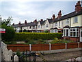


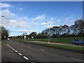


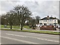
32 photos from this area
Area Information
Key information about the ST5 8EA including its size, population, and administrative classification.
- Area Type
- Postcode
- Area Size
- 1.1 hectares
- Population
- 1472
- Population Density
- 4130 people/km²
House Prices in ST5 8EA
30
Properties
£146,939
Average Sold Price
£40,000
Lowest Price
£250,000
Highest Price
Showing 30 properties
| Address | Type | Beds | Baths | Last Sale Price | Last Sale Date | |
|---|---|---|---|---|---|---|
| 216 Dimsdale Parade West, Newcastle Under Lyme, ST5 8EA | Semi-detached | 3 | 1 | £250,000 | Nov 2025 | |
| 240 Dimsdale Parade West, Newcastle Under Lyme, ST5 8EA | Semi-detached | 3 | 1 | £161,000 | Mar 2025 | |
| 254 Dimsdale Parade West, Newcastle Under Lyme, ST5 8EA | Semi-detached | 3 | 1 | £200,000 | Mar 2024 | |
| 226 Dimsdale Parade West, Newcastle Under Lyme, ST5 8EA | Semi-detached | 3 | - | £140,000 | Jul 2023 | |
| 228 Dimsdale Parade West, Newcastle Under Lyme, ST5 8EA | Detached | 4 | 2 | £240,000 | Apr 2023 | |
| 244 Dimsdale Parade West, Newcastle Under Lyme, ST5 8EA | Semi-detached | 3 | 1 | £245,000 | Feb 2023 | |
| 250 Dimsdale Parade West, Newcastle Under Lyme, ST5 8EA | Semi-detached | 3 | 1 | £225,000 | Oct 2022 | |
| 200 Dimsdale Parade West, Newcastle Under Lyme, ST5 8EA | house | - | - | £159,950 | May 2021 | |
| 256 Dimsdale Parade West, Newcastle Under Lyme, ST5 8EA | house | 3 | - | £175,500 | Feb 2020 | |
| 214 Dimsdale Parade West, Newcastle Under Lyme, ST5 8EA | house | 3 | - | £138,000 | Sep 2011 |
Page 1 of 3
Energy Efficiency in ST5 8EA
Amenities
Schools
| Rank | School | Type | Entry gender | Ages |
|---|
Explore more schools in this area
Go to Schools tabDemographics
Household Size
Family (3-5 people)
most common
Accommodation Type
Houses
most common
Tenure
84
majority
Ethnic Group
White
most common
Religion
N/A
most common
Household Composition
N/A
most common
Age
47
median
Adults (30-64 years)
most common
Household Deprivation
N/A
with no deprivation
NS-SEC
32
in Lower managerial occupations
Explore more demographic insights in this area
Go to Demographics tabPlanning
Planning Constraints
- Flood RiskPremium
- Ramsar Wetland SitesPremium
- Area of Outstanding Natural BeautyPremium
- Protected Nature ReservePremium
- Protected WoodlandPremium