Area Overview for ST5 6SA
Photos of ST5 6SA
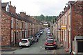
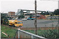
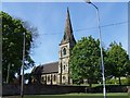
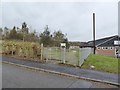
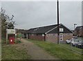
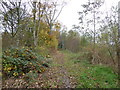
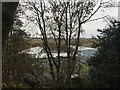
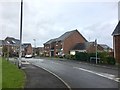
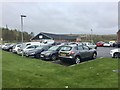
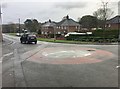
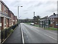
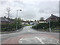
76 photos from this area
Area Information
Key information about the ST5 6SA including its size, population, and administrative classification.
- Area Type
- Postcode
- Area Size
- 1.7 hectares
- Population
- 1810
- Population Density
- 1258 people/km²
House Prices in ST5 6SA
21
Properties
£137,410
Average Sold Price
£52,000
Lowest Price
£229,950
Highest Price
Showing 21 properties
| Address | Type | Beds | Baths | Last Sale Price | Last Sale Date | |
|---|---|---|---|---|---|---|
| 8 Hulme Close, Newcastle Under Lyme, ST5 6SA | Detached | 2 | 1 | £180,000 | Nov 2025 | |
| 7 Hulme Close, Newcastle Under Lyme, ST5 6SA | Detached | 3 | 1 | £229,950 | Nov 2024 | |
| 20 Hulme Close, Newcastle Under Lyme, ST5 6SA | Bungalow | 2 | 1 | £222,500 | Sep 2023 | |
| 11 Hulme Close, Newcastle Under Lyme, ST5 6SA | Bungalow | 2 | 1 | £170,000 | Aug 2023 | |
| 16 Hulme Close, Newcastle Under Lyme, ST5 6SA | Bungalow | 2 | 1 | £190,000 | May 2023 | |
| 4 Hulme Close, Newcastle Under Lyme, ST5 6SA | Bungalow | 2 | 1 | £150,000 | Sep 2017 | |
| 2 Hulme Close, Newcastle Under Lyme, ST5 6SA | Bungalow | 2 | 1 | £148,000 | Dec 2016 | |
| 23 Hulme Close, Newcastle Under Lyme, ST5 6SA | Detached | 3 | 1 | £135,000 | May 2016 | |
| 18 Hulme Close, Newcastle Under Lyme, ST5 6SA | Bungalow | - | - | £125,000 | Jan 2013 | |
| 14 Hulme Close, Newcastle Under Lyme, ST5 6SA | Bungalow | - | - | £135,000 | Dec 2009 |
Page 1 of 3
Energy Efficiency in ST5 6SA
Amenities
Schools
| Rank | School | Type | Entry gender | Ages |
|---|
Explore more schools in this area
Go to Schools tabDemographics
Household Size
One person
most common
Accommodation Type
Houses
most common
Tenure
66
majority
Ethnic Group
White
most common
Religion
N/A
most common
Household Composition
N/A
most common
Age
47
median
Adults (30-64 years)
most common
Household Deprivation
N/A
with no deprivation
NS-SEC
20
in Lower managerial occupations
Explore more demographic insights in this area
Go to Demographics tabPlanning
Planning Constraints
- Flood RiskPremium
- Ramsar Wetland SitesPremium
- Area of Outstanding Natural BeautyPremium
- Protected Nature ReservePremium
- Protected WoodlandPremium