Area Overview for ST5 6QN
Photos of ST5 6QN
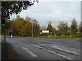
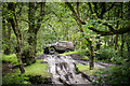

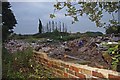
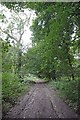
24 photos from this area
Area Information
Key information about the ST5 6QN including its size, population, and administrative classification.
- Area Type
- Postcode
- Area Size
- 1.9 hectares
- Population
- 2588
- Population Density
- 1757 people/km²
House Prices in ST5 6QN
31
Properties
£70,271
Average Sold Price
£23,950
Lowest Price
£120,000
Highest Price
Showing 31 properties
| Address | Type | Beds | Baths | Last Sale Price | Last Sale Date | |
|---|---|---|---|---|---|---|
| 103 Bath Road, Newcastle Under Lyme, ST5 6QN | Semi-detached | 3 | 1 | £120,000 | Sep 2025 | |
| 95 Bath Road, Newcastle Under Lyme, ST5 6QN | house | - | - | £92,500 | May 2020 | |
| 131 Bath Road, Newcastle Under Lyme, ST5 6QN | Terraced | 3 | 1 | £101,763 | Feb 2020 | |
| 115 Bath Road, Newcastle Under Lyme, ST5 6QN | house | 3 | - | £85,000 | Jun 2019 | |
| 75 Bath Road, Newcastle Under Lyme, ST5 6QN | Semi-detached | 3 | 1 | £90,000 | Feb 2019 | |
| 73 Bath Road, Newcastle Under Lyme, ST5 6QN | Semi-detached | 3 | 1 | £52,000 | Sep 2018 | |
| 111 Bath Road, Newcastle Under Lyme, ST5 6QN | Semi-detached | 3 | 1 | £70,000 | Jul 2018 | |
| 127 Bath Road, Newcastle Under Lyme, ST5 6QN | house | - | - | £41,500 | Aug 2003 | |
| 77 Bath Road, Newcastle Under Lyme, ST5 6QN | house | - | - | £26,000 | Aug 2002 | |
| 101 Bath Road, Newcastle Under Lyme, ST5 6QN | Retail | 4 | 1 | £23,950 | May 2002 |
Page 1 of 4
Energy Efficiency in ST5 6QN
Amenities
Schools
| Rank | School | Type | Entry gender | Ages |
|---|
Explore more schools in this area
Go to Schools tabDemographics
Household Size
Family (3-5 people)
most common
Accommodation Type
Houses
most common
Tenure
58
majority
Ethnic Group
White
most common
Religion
N/A
most common
Household Composition
N/A
most common
Age
47
median
Adults (30-64 years)
most common
Household Deprivation
N/A
with no deprivation
NS-SEC
27
in Lower managerial occupations
Explore more demographic insights in this area
Go to Demographics tabPlanning
Planning Constraints
- Flood RiskPremium
- Ramsar Wetland SitesPremium
- Area of Outstanding Natural BeautyPremium
- Protected Nature ReservePremium
- Protected WoodlandPremium