Area Overview for ST5 6NB
Photos of ST5 6NB
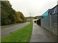
37 photos from this area
Area Information
Key information about the ST5 6NB including its size, population, and administrative classification.
- Area Type
- Postcode
- Area Size
- 3592 m²
- Population
- 1810
- Population Density
- 1258 people/km²
House Prices in ST5 6NB
23
Properties
£61,055
Average Sold Price
£11,000
Lowest Price
£106,500
Highest Price
Showing 23 properties
| Address | Type | Beds | Baths | Last Sale Price | Last Sale Date | |
|---|---|---|---|---|---|---|
| 6 Abbey Street, Newcastle Under Lyme, ST5 6NB | Terraced | 2 | 1 | £87,550 | Dec 2024 | |
| 12 Abbey Street, Newcastle Under Lyme, ST5 6NB | Terraced | 1 | 2 | £80,000 | Jul 2023 | |
| 8 Abbey Street, Newcastle Under Lyme, ST5 6NB | house | 3 | 2 | £106,500 | Sep 2014 | |
| 7 Abbey Street, Newcastle Under Lyme, ST5 6NB | house | - | - | £71,000 | Sep 2012 | |
| 4 Abbey Street, Newcastle Under Lyme, ST5 6NB | Terraced | 2 | - | £67,000 | Aug 2011 | |
| 13 Abbey Street, Newcastle Under Lyme, ST5 6NB | house | 3 | - | £98,000 | Aug 2008 | |
| 17 Abbey Street, Newcastle Under Lyme, ST5 6NB | house | - | - | £31,000 | Apr 2001 | |
| 2 Abbey Street, Newcastle Under Lyme, ST5 6NB | house | - | - | £11,000 | Mar 2000 | |
| 20 Abbey Street, Newcastle Under Lyme, ST5 6NB | house | - | - | £30,500 | Sep 1997 | |
| 9 Abbey Street, Newcastle Under Lyme, ST5 6NB | house | 3 | - | £28,000 | Jan 1996 |
Page 1 of 3
Energy Efficiency in ST5 6NB
Amenities
Schools
| Rank | School | Type | Entry gender | Ages |
|---|
Explore more schools in this area
Go to Schools tabDemographics
Household Size
One person
most common
Accommodation Type
Houses
most common
Tenure
66
majority
Ethnic Group
White
most common
Religion
N/A
most common
Household Composition
N/A
most common
Age
47
median
Adults (30-64 years)
most common
Household Deprivation
N/A
with no deprivation
NS-SEC
20
in Lower managerial occupations
Explore more demographic insights in this area
Go to Demographics tabPlanning
Planning Constraints
- Flood RiskPremium
- Ramsar Wetland SitesPremium
- Area of Outstanding Natural BeautyPremium
- Protected Nature ReservePremium
- Protected WoodlandPremium