Area Overview for ST5 3HR
Photos of ST5 3HR

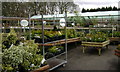

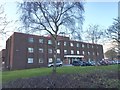
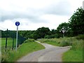
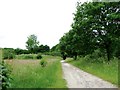
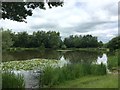

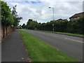
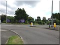
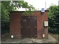
32 photos from this area
Area Information
Key information about the ST5 3HR including its size, population, and administrative classification.
- Area Type
- Postcode
- Area Size
- 1.3 hectares
- Population
- 1515
- Population Density
- 4481 people/km²
House Prices in ST5 3HR
16
Properties
£136,075
Average Sold Price
£51,000
Lowest Price
£208,500
Highest Price
Showing 16 properties
| Address | Type | Beds | Baths | Last Sale Price | Last Sale Date | |
|---|---|---|---|---|---|---|
| 160 Clayton Road, Newcastle Under Lyme, ST5 3HR | Semi-detached | 2 | 1 | £160,000 | Feb 2023 | |
| 152 Clayton Road, Newcastle Under Lyme, ST5 3HR | Semi-detached | 3 | 1 | £208,500 | Dec 2022 | |
| 170 Clayton Road, Newcastle Under Lyme, ST5 3HR | house | - | - | £132,950 | Aug 2020 | |
| 156 Clayton Road, Newcastle Under Lyme, ST5 3HR | house | - | - | £166,500 | Jul 2020 | |
| 168 Clayton Road, Newcastle Under Lyme, ST5 3HR | Semi-detached | - | - | £97,500 | Dec 2006 | |
| 176 Clayton Road, Newcastle Under Lyme, ST5 3HR | Semi-detached | - | - | £51,000 | Jun 2002 | |
| 166 Clayton Road, Newcastle Under Lyme, ST5 3HR | Semi-detached | - | - | - | - | |
| 178 Clayton Road, Newcastle Under Lyme, ST5 3HR | house | - | - | - | - | |
| 172 Clayton Road, Newcastle Under Lyme, ST5 3HR | house | - | - | - | - | |
| 174 Clayton Road, Newcastle Under Lyme, ST5 3HR | house | - | - | - | - |
Page 1 of 2
Energy Efficiency in ST5 3HR
Amenities
Schools
| Rank | School | Type | Entry gender | Ages |
|---|
Explore more schools in this area
Go to Schools tabDemographics
Household Size
One person
most common
Accommodation Type
Houses
most common
Tenure
48
majority
Ethnic Group
White
most common
Religion
N/A
most common
Household Composition
N/A
most common
Age
47
median
Adults (30-64 years)
most common
Household Deprivation
N/A
with no deprivation
NS-SEC
23
in Lower managerial occupations
Explore more demographic insights in this area
Go to Demographics tabPlanning
Planning Constraints
- Flood RiskPremium
- Ramsar Wetland SitesPremium
- Area of Outstanding Natural BeautyPremium
- Protected Nature ReservePremium
- Protected WoodlandPremium