Area Overview for ST4 8ND
Photos of ST4 8ND

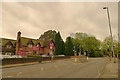
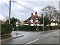

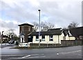

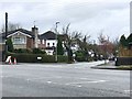
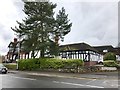

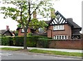
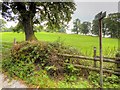
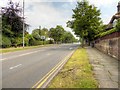
15 photos from this area
Area Information
Key information about the ST4 8ND including its size, population, and administrative classification.
- Area Type
- Postcode
- Area Size
- 1.8 hectares
- Population
- 1368
- Population Density
- 2686 people/km²
House Prices in ST4 8ND
21
Properties
£192,536
Average Sold Price
£36,000
Lowest Price
£420,000
Highest Price
Showing 21 properties
| Address | Type | Beds | Baths | Last Sale Price | Last Sale Date | |
|---|---|---|---|---|---|---|
| 57 Longton Road, Trentham, Stoke On Trent, ST4 8ND | Detached | 3 | - | £250,000 | Mar 2025 | |
| 5 Longton Road, Trentham, Stoke On Trent, ST4 8ND | Terraced | 2 | 1 | £250,000 | May 2023 | |
| 9 Longton Road, Trentham, Stoke On Trent, ST4 8ND | Detached | 3 | 2 | £420,000 | Jun 2021 | |
| Primrose Cottage, 29 Longton Road, Trentham, Stoke On Trent, ST4 8ND | house | - | - | £305,000 | May 2021 | |
| 47 Longton Road, Trentham, Stoke On Trent, ST4 8ND | Terraced | 2 | 1 | £211,000 | Mar 2020 | |
| 41 Longton Road, Trentham, Stoke On Trent, ST4 8ND | Detached | 5 | - | £285,000 | Jul 2014 | |
| 31 Longton Road, Trentham, Stoke On Trent, ST4 8ND | Detached | 3 | - | £230,000 | Jun 2014 | |
| 3 Longton Road, Trentham, Stoke On Trent, ST4 8ND | Cottage | 3 | 1 | £110,000 | Jan 2012 | |
| 51 Longton Road, Trentham, Stoke On Trent, ST4 8ND | Semi-detached | - | - | £250,000 | Jul 2007 | |
| 27 Longton Road, Trentham, Stoke On Trent, ST4 8ND | Semi-detached | - | - | £115,000 | Oct 2001 |
Page 1 of 3
Energy Efficiency in ST4 8ND
Amenities
Schools
| Rank | School | Type | Entry gender | Ages |
|---|
Explore more schools in this area
Go to Schools tabDemographics
Household Size
Two person
most common
Accommodation Type
Houses
most common
Tenure
90
majority
Ethnic Group
White
most common
Religion
N/A
most common
Household Composition
N/A
most common
Age
47
median
Adults (30-64 years)
most common
Household Deprivation
N/A
with no deprivation
NS-SEC
35
in Lower managerial occupations
Explore more demographic insights in this area
Go to Demographics tabPlanning
Planning Constraints
- Flood RiskPremium
- Ramsar Wetland SitesPremium
- Area of Outstanding Natural BeautyPremium
- Protected Nature ReservePremium
- Protected WoodlandPremium