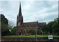
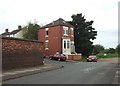
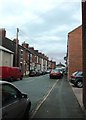
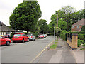
Area Overview for ST4 7LF
Photos of ST4 7LF
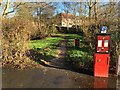
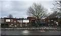
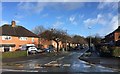
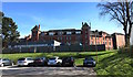
100 photos from this area
Area Information
Key information about the ST4 7LF including its size, population, and administrative classification.
- Area Type
- Postcode
- Area Size
- 2.1 hectares
- Population
- 1507
- Population Density
- 5765 people/km²
House Prices in ST4 7LF
22
Properties
£221,346
Average Sold Price
£71,500
Lowest Price
£340,000
Highest Price
Showing 22 properties
| Address | Type | Beds | Baths | Last Sale Price | Last Sale Date | |
|---|---|---|---|---|---|---|
| 193 Queens Road, Hartshill, Stoke On Trent, ST4 7LF | Bungalow | 3 | 1 | £303,000 | Dec 2024 | |
| 201 Queens Road, Hartshill, Stoke On Trent, ST4 7LF | house | - | - | £305,000 | Feb 2022 | |
| 207 Queens Road, Hartshill, Stoke On Trent, ST4 7LF | Semi-detached | 4 | 2 | £335,000 | Feb 2020 | |
| 229 Queens Road, Hartshill, Stoke On Trent, ST4 7LF | house | - | - | £215,000 | Sep 2019 | |
| 215 Queens Road, Hartshill, Stoke On Trent, ST4 7LF | Detached | 4 | 2 | £340,000 | May 2018 | |
| Canada Cottage, 235 Queens Road, Hartshill, Stoke On Trent, ST4 7LF | Detached | 4 | 1 | £260,000 | Feb 2017 | |
| 211 Queens Road, Hartshill, Stoke On Trent, ST4 7LF | Detached | 3 | 1 | £169,500 | Dec 2012 | |
| 191 Queens Road, Hartshill, Stoke On Trent, ST4 7LF | house | 3 | - | £175,500 | Oct 2011 | |
| 189 Queens Road, Hartshill, Stoke On Trent, ST4 7LF | house | - | - | £215,000 | Mar 2010 | |
| 241 Queens Road, Hartshill, Stoke On Trent, ST4 7LF | Detached | - | - | £185,000 | Dec 2006 |
Page 1 of 3
Energy Efficiency in ST4 7LF
Amenities
Schools
| Rank | School | Type | Entry gender | Ages |
|---|
Explore more schools in this area
Go to Schools tabDemographics
Household Size
Two person
most common
Accommodation Type
Houses
most common
Tenure
65
majority
Ethnic Group
White
most common
Religion
N/A
most common
Household Composition
N/A
most common
Age
47
median
Adults (30-64 years)
most common
Household Deprivation
N/A
with no deprivation
NS-SEC
35
in Lower managerial occupations
Explore more demographic insights in this area
Go to Demographics tabPlanning
Planning Constraints
- Flood RiskPremium
- Ramsar Wetland SitesPremium
- Area of Outstanding Natural BeautyPremium
- Protected Nature ReservePremium
- Protected WoodlandPremium